


Reviewed by Julianne M.
Verified Buyer
I recommend this product
Really beautiful map
Our customizations were printed perfectly and my husband loves it.
Loading...
Was this helpful?
Standard maps will enter production right away, within the next business day. Larger orders may take more time.
All push pin board maps (framed or canvas wrap) include push pins, are easy to hang, and ship free in the continental US. We'll select the optimal shipping method for fast delivery.
For personalized maps we collaborate closely to guarantee satisfaction. Expect a proof to be sent to you. Your swift responses will facilitate the production and shipping process.
If there are any problems with your map we will take care of you. Returns for all maps are straightforward and hassle-free.
For personalized maps, engaging with the email proofs we send ensures that the final product meets your expectations precisely.
We have 30+ years of cartography experience, meticulously craft each order by hand to ensure excellence, and 100% guarantee your satisfaction. We produce maps that are built to last, with state of the art production and archival quality materials.
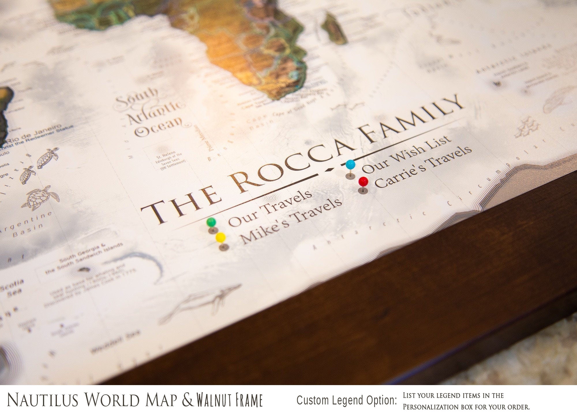
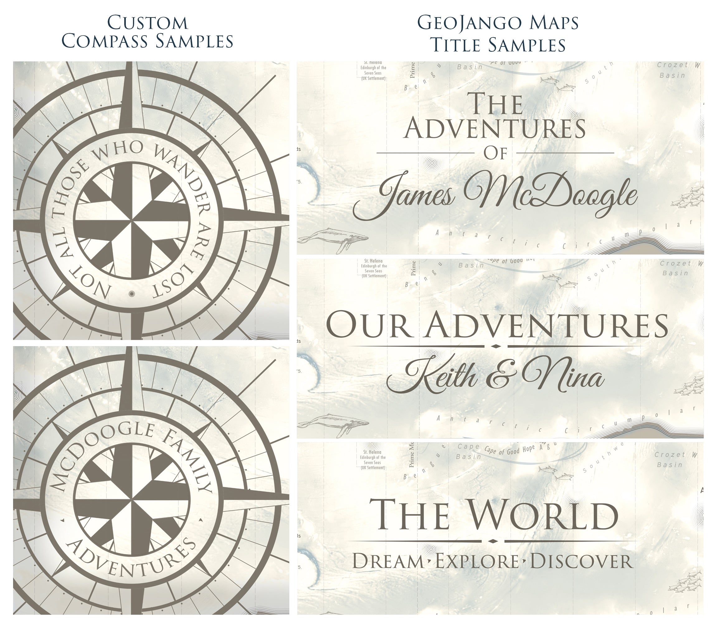
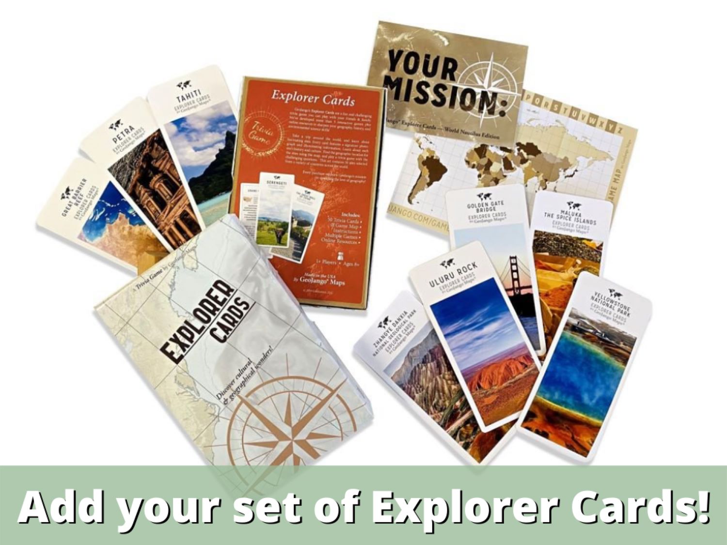
Customize with quotes, legends, or dedications using "Personalize Map" options to craft your masterpiece map. Or reach out to us if you don't see the option you want.
We collaborate with you from design to approval of your proof so that you are 100% happy before we print and ship.
Our excellent customer service is always open to you.
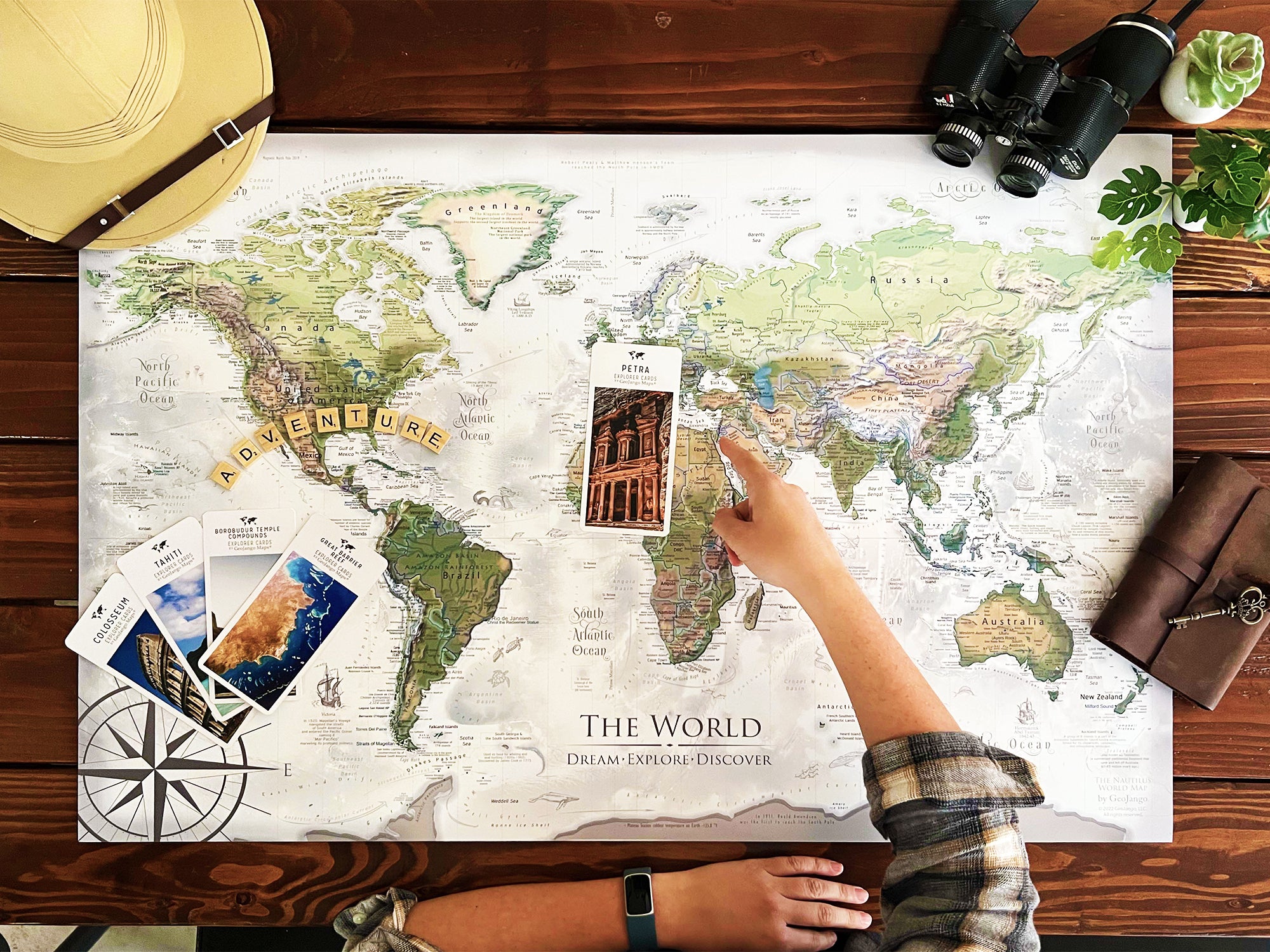
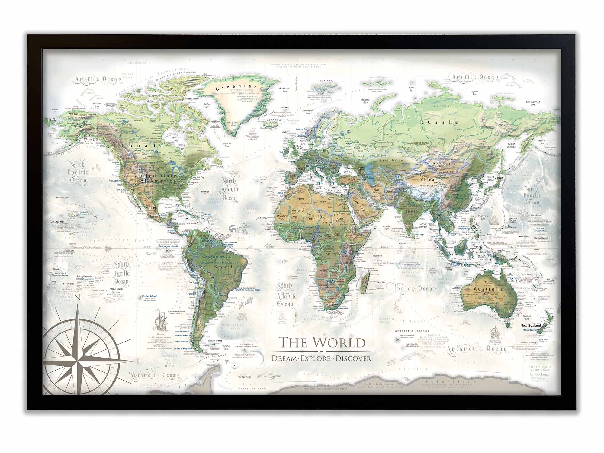
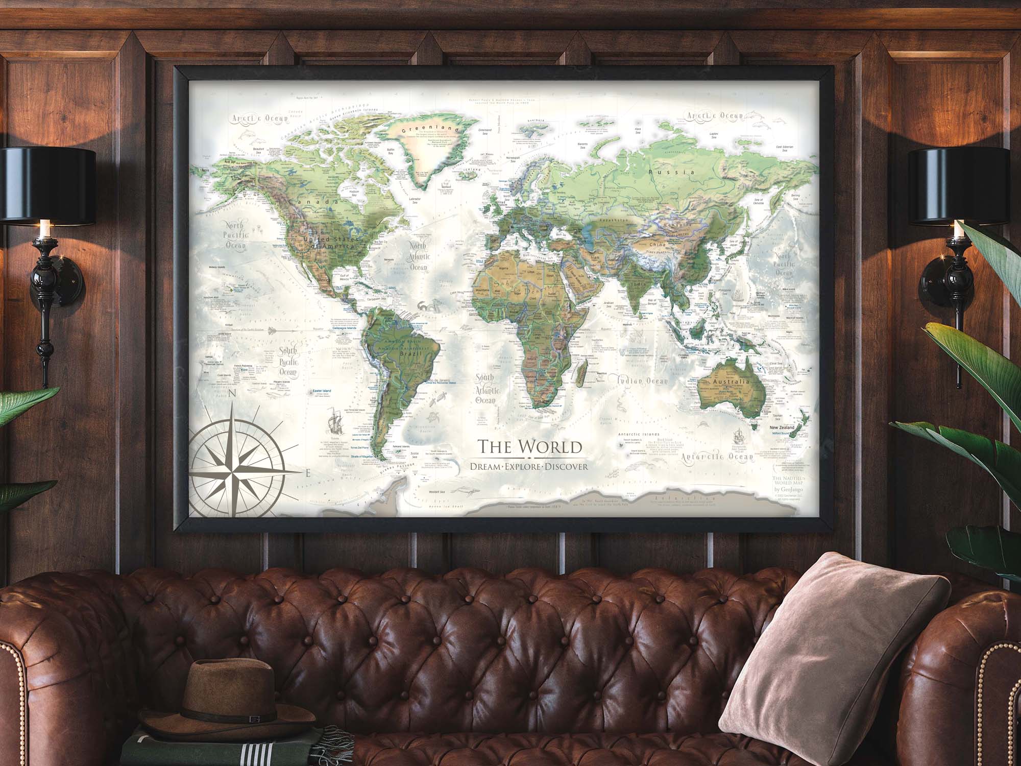
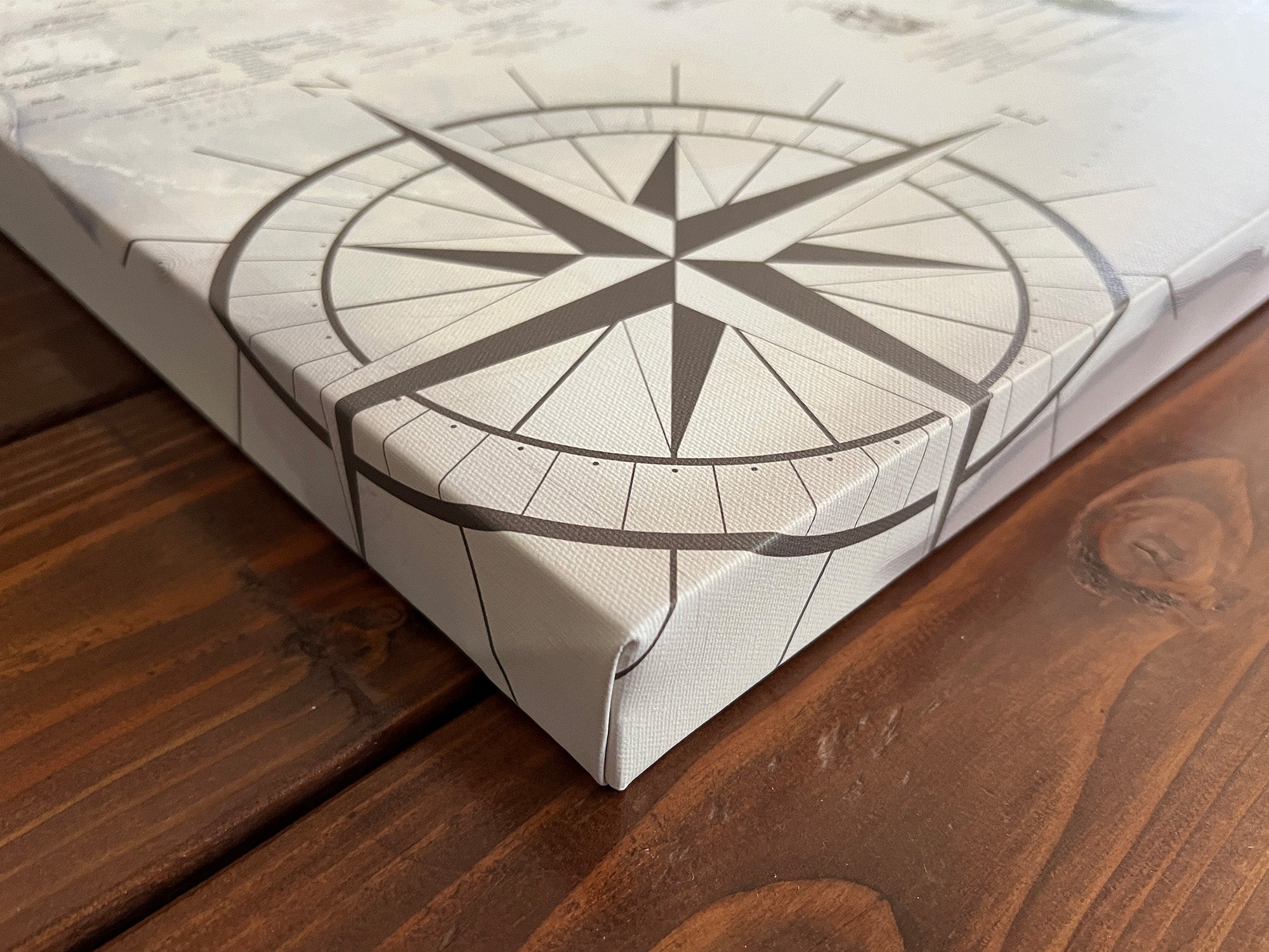
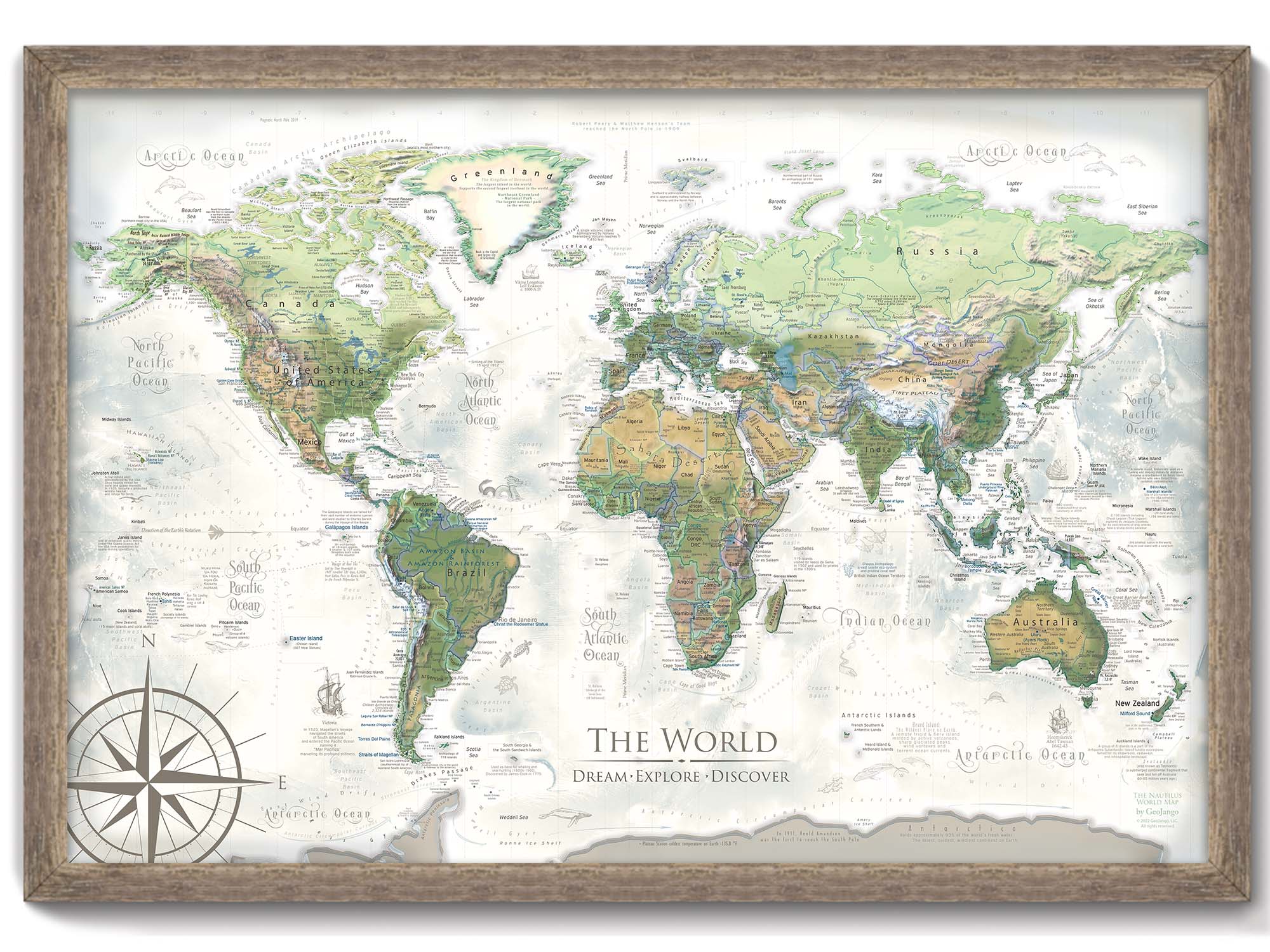
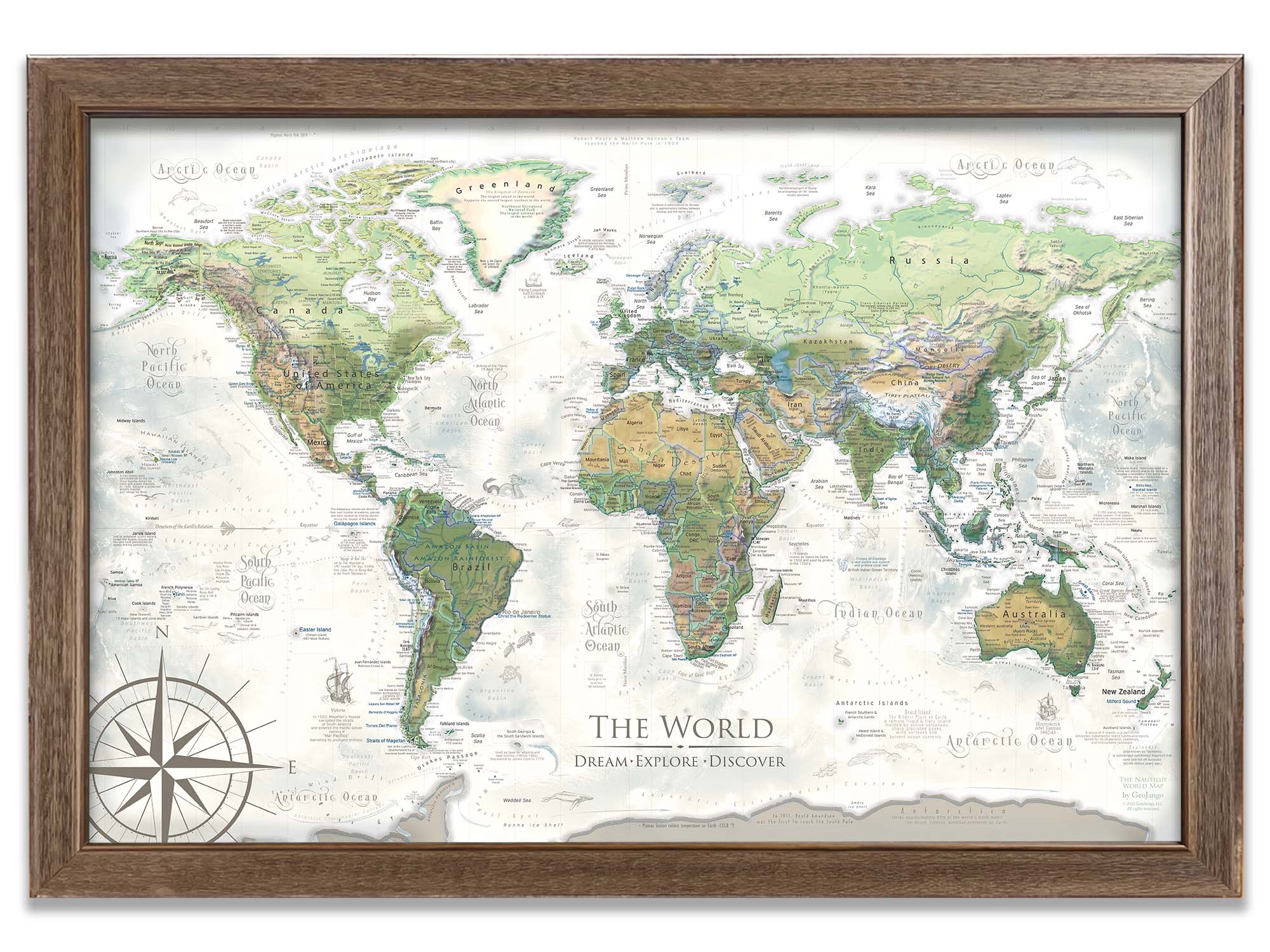
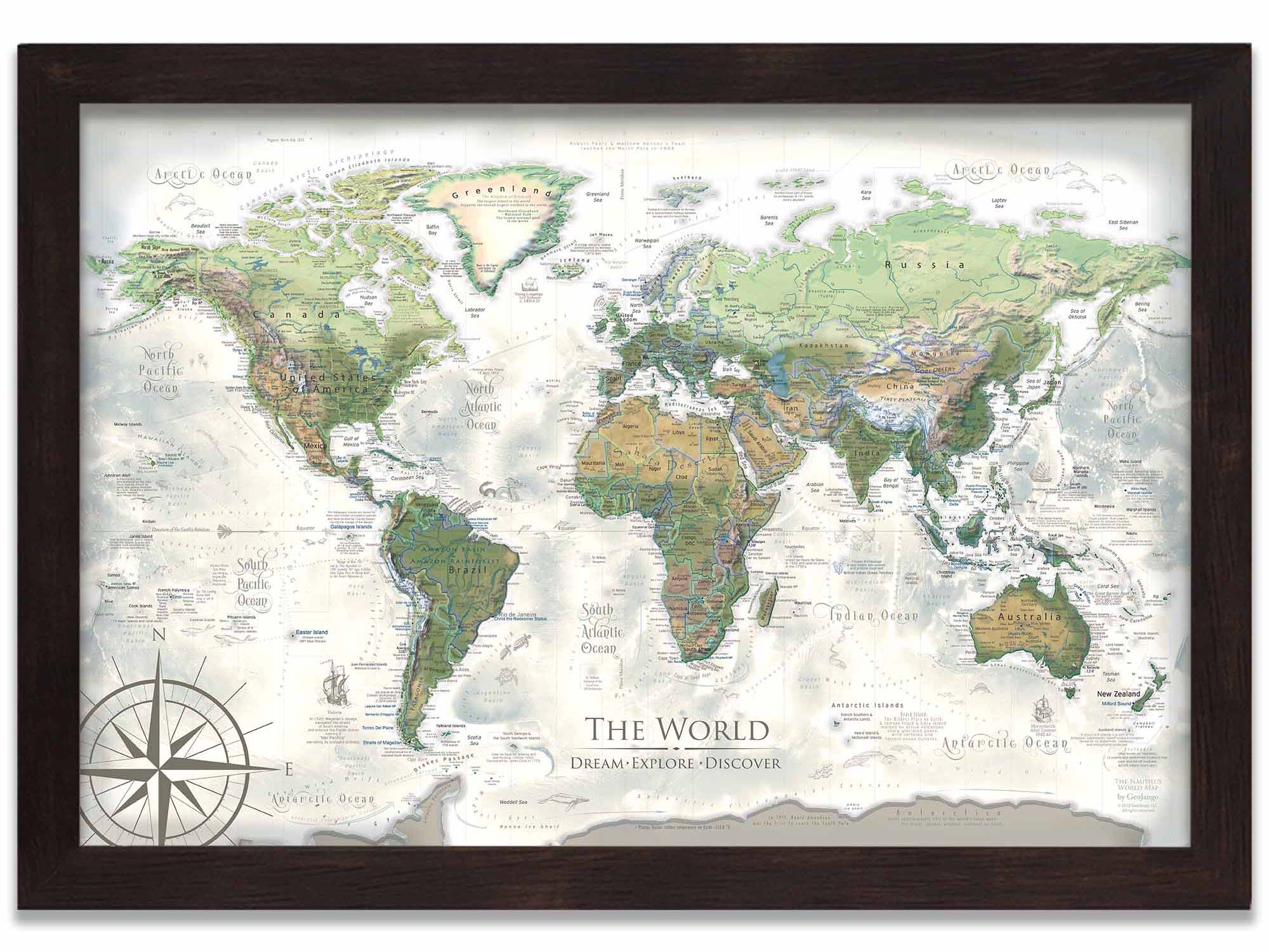
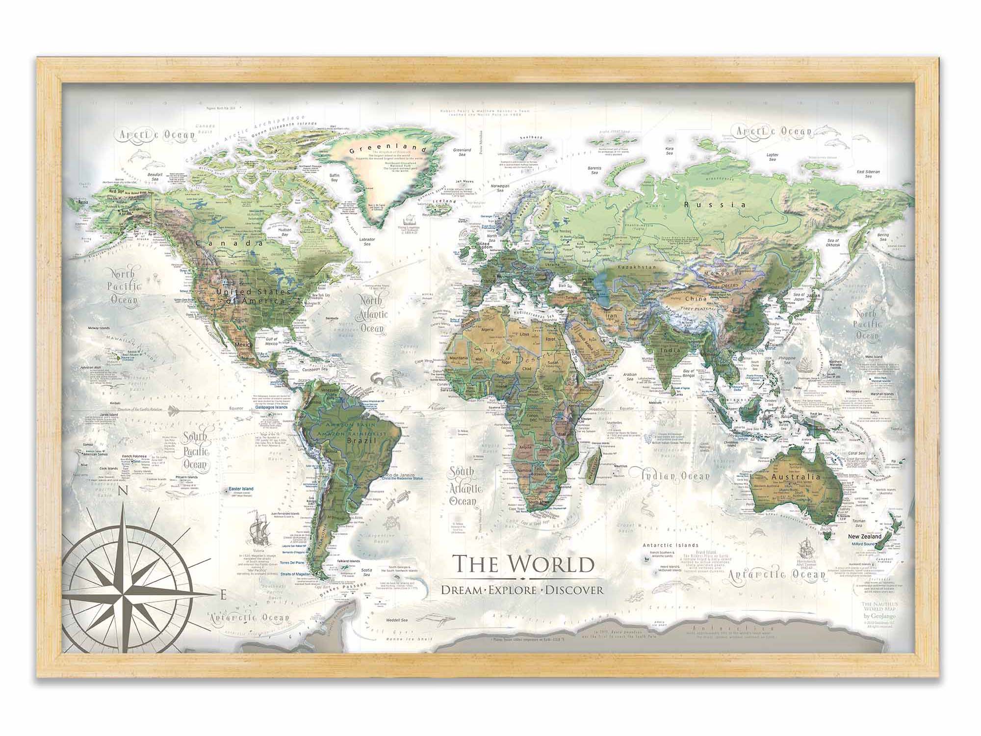
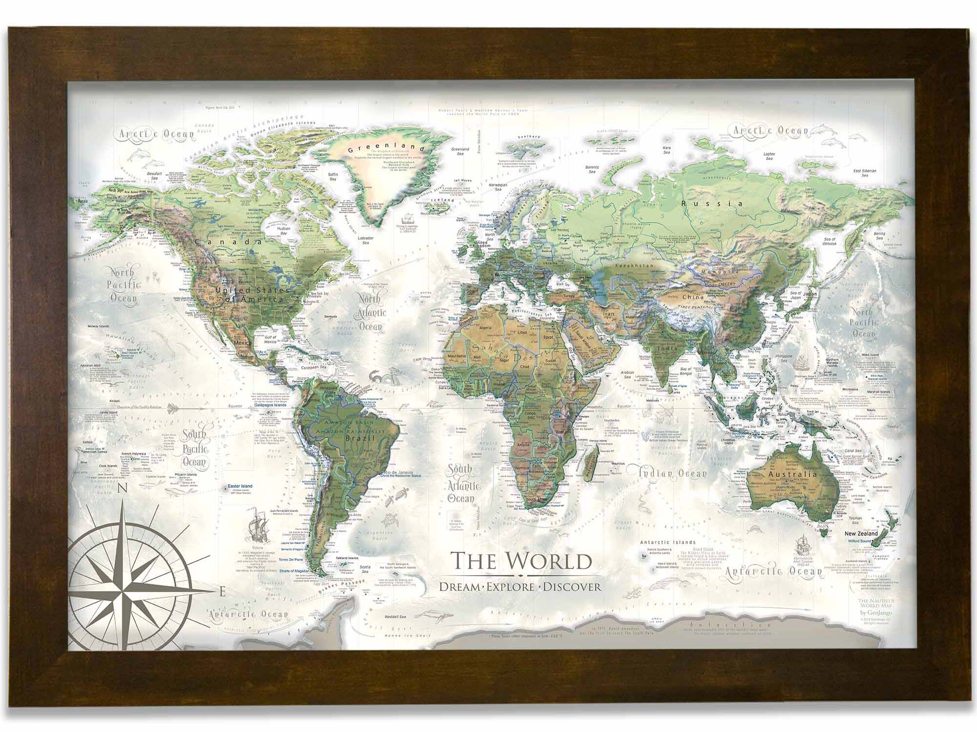
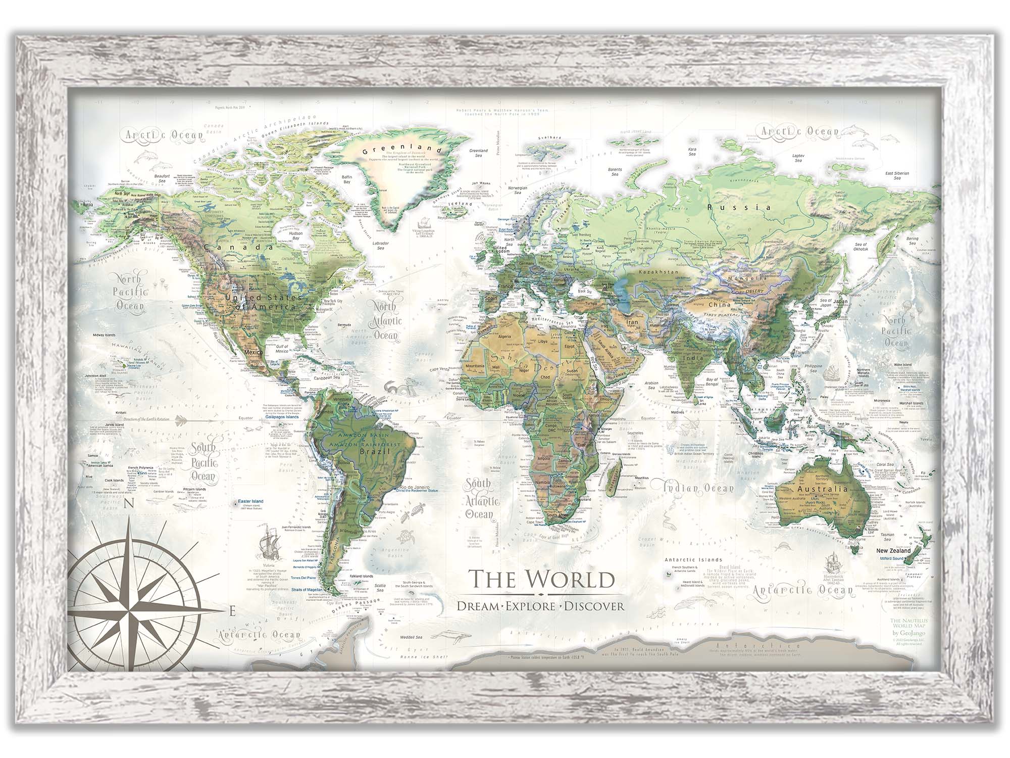
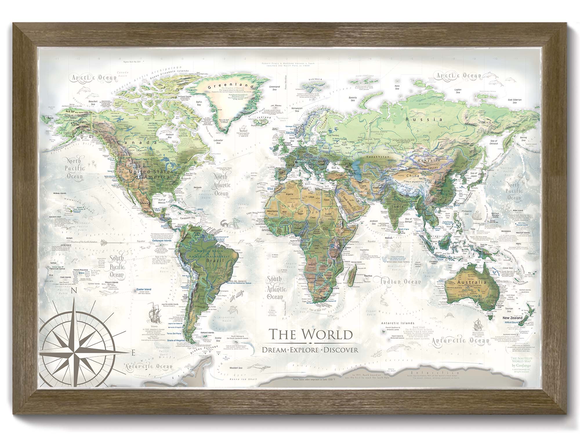
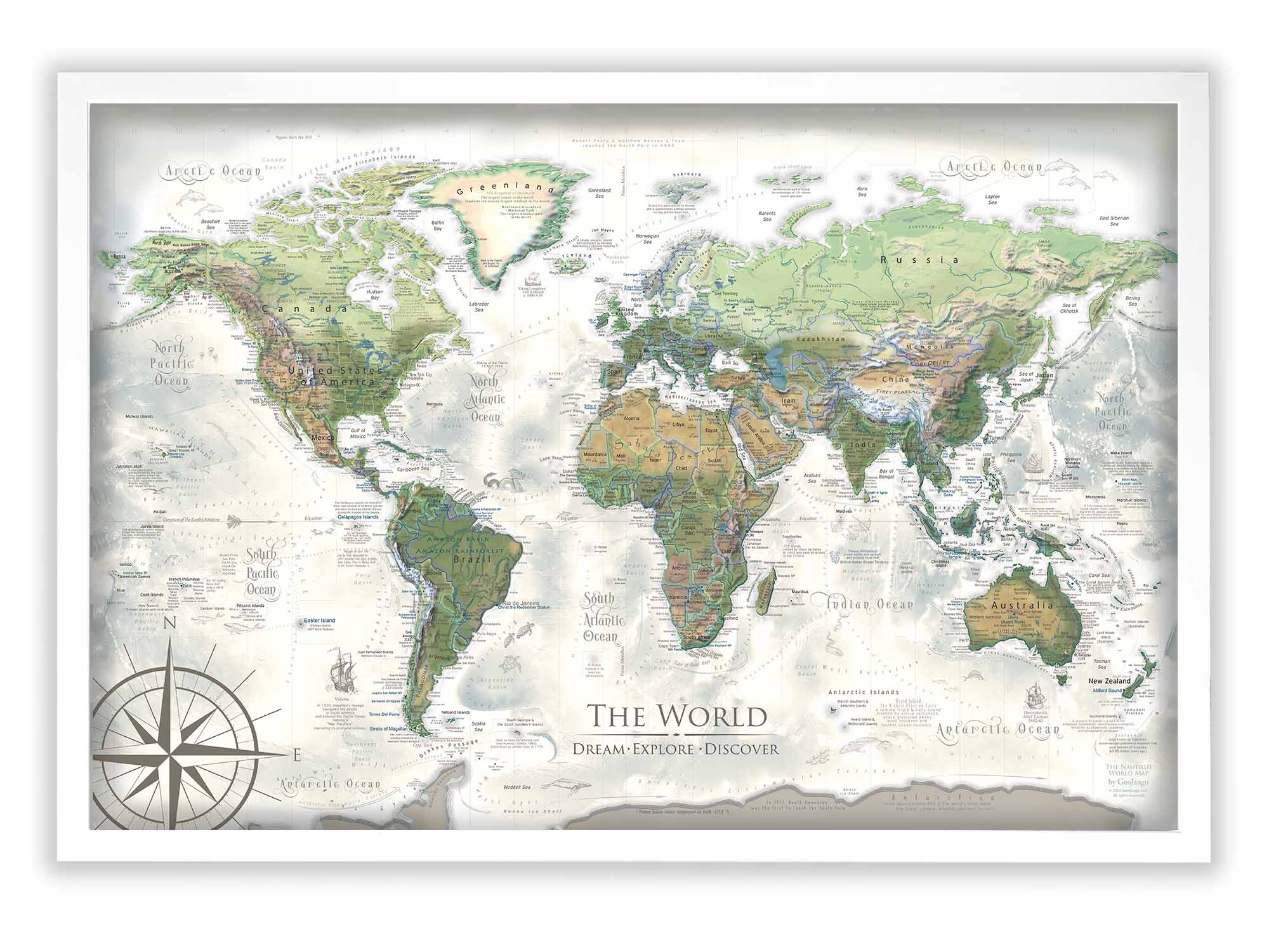
Discover the Nautilus Push Pin World Map, a magnificent blend of art and scientific exploration of our Earth. Crafted with fine art materials, this map serves as both a functional push-pin travel tracker and a stunning piece of wall art. It is meticulously created by skilled cartographers and geographers, encapsulating years of geographic study.
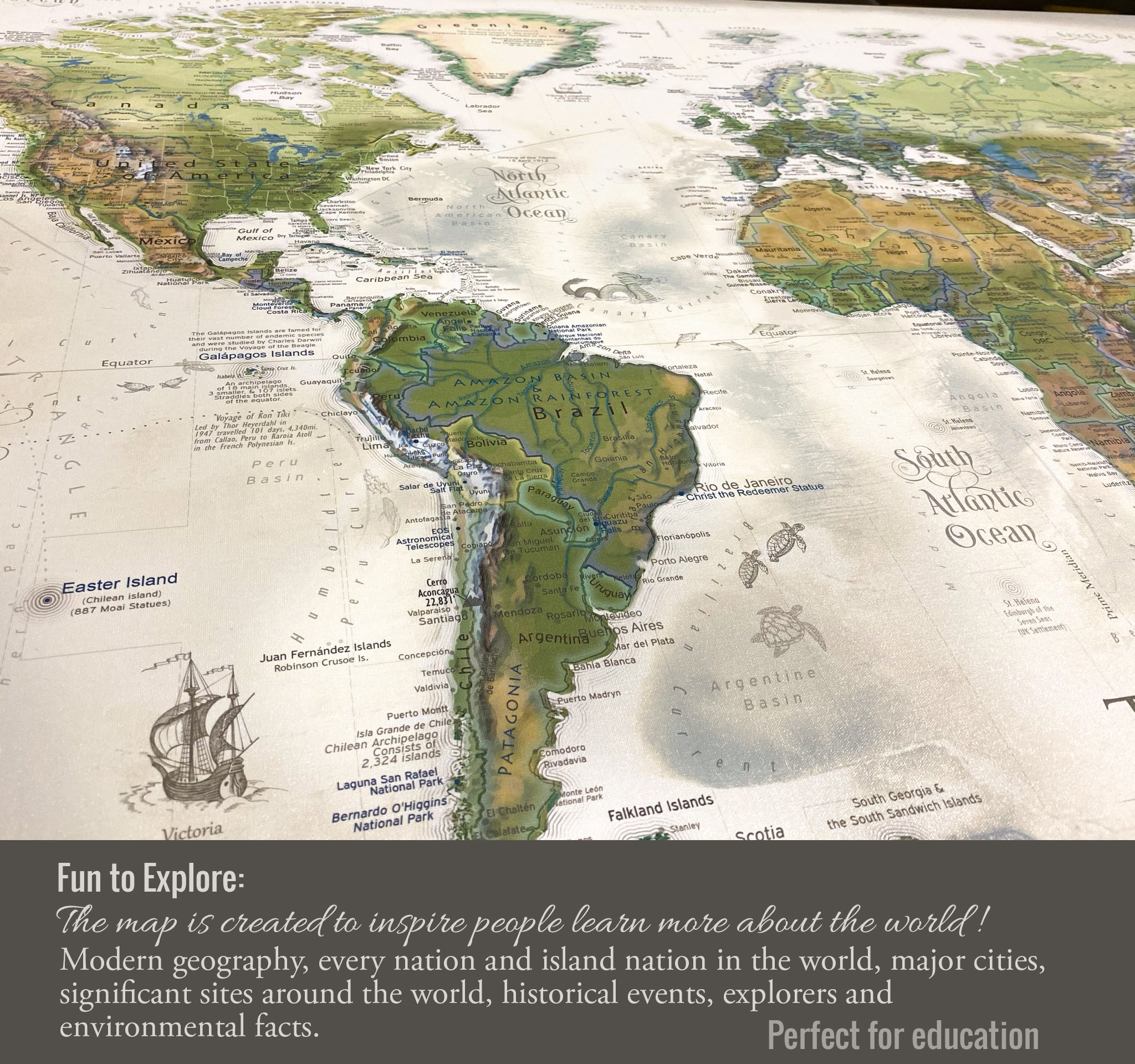
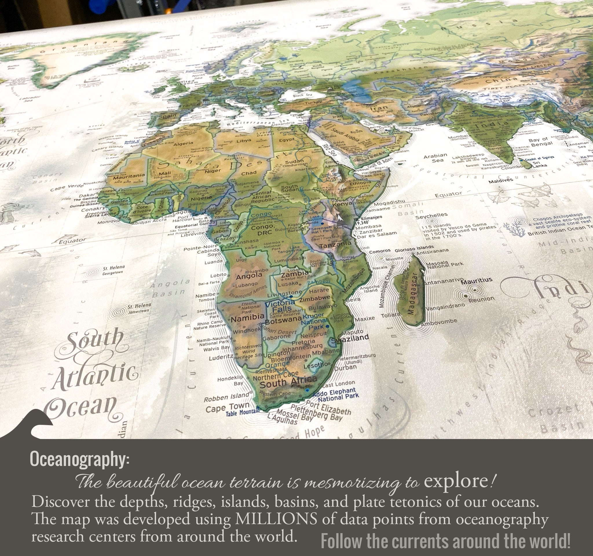
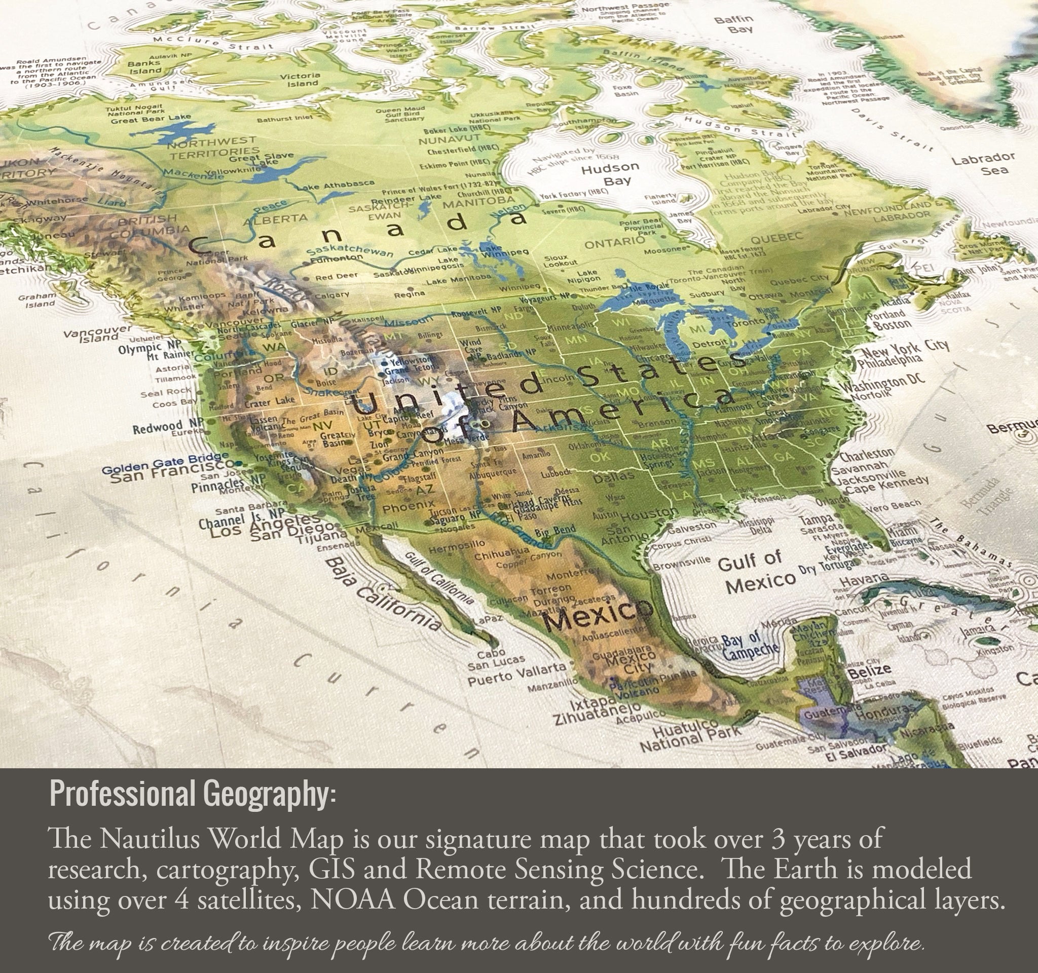
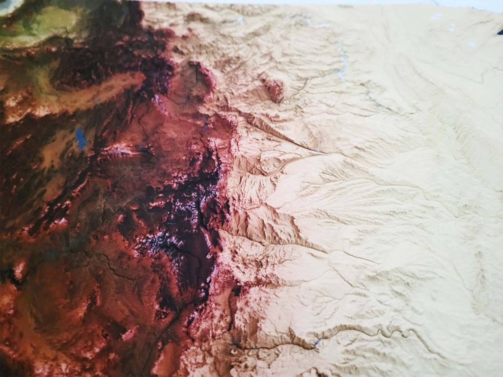
Experience the richness of the world's landscapes with our advanced terrain modeling, which illustrates variations in elevation, and our landscape modeling that differentiates regions such as rainforests, deserts, tundras, mountain ranges, and more. The map provides an extensive array of details, from the deepest ocean trenches to the highest mountain peaks, the courses of ocean currents, to the realms of ancient civilizations.
Enhance your understanding of Earth’s physical and oceanographic features through this map. It not only visualizes the planet's natural beauty but also serves as a comprehensive educational tool. The Nautilus map highlights historical routes and noteworthy explorations that shaped the world as we know it today. Use the map as a guide to learn about significant sites on our planet.
Perfect for educators, travelers, and geography enthusiasts, this world map invites you to explore both celebrated and lesser-known significant sites across the globe, making it an invaluable addition to any space.
What is the difference between the maps?: Check out this outline of our world Map Comparisons.
Geographical Data: The map is created using a combination of satellites and developed entirely using numbers, measurements, and GIS software.
We use the USGS LandSat satellite to visualize the landscape on land and NOAA's bathymetry data to visualize the elevation and topography of the sea floor. The famous Space Shuttle Radiometric Topographic Mission, SRTM Data, is used to gather the elevation height for the land. With the data, we applied a hill shade to visualize the shading effects (at 3 p.m. every where on Earth). This is most visible in the largest mountain regions around the world.
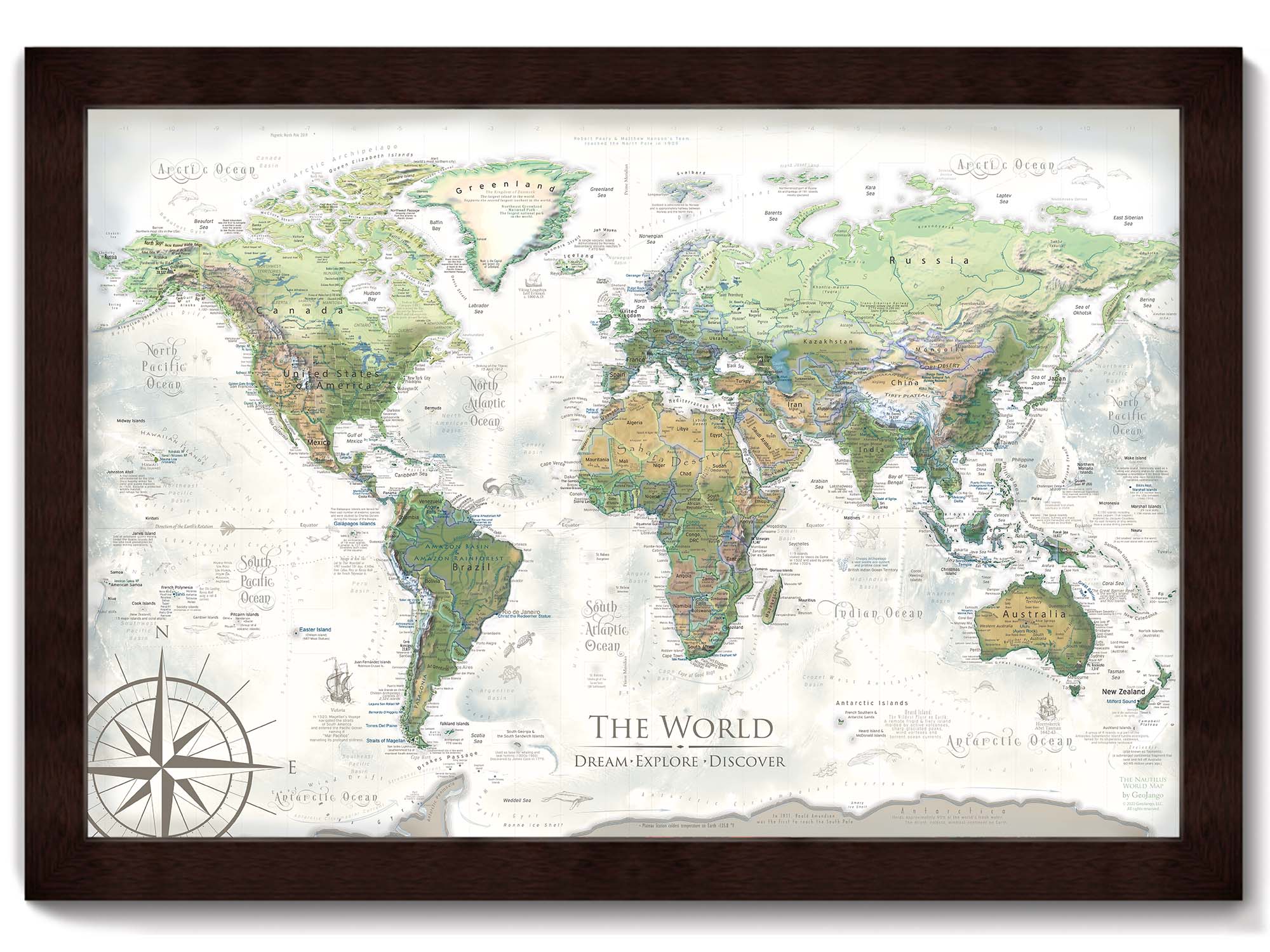
What's the difference between the Nautilus and Voyager World Maps? The Voyager World Maps feature blue oceans and the Nautilus World Map features the ocean in a spectacular spectrum of colors that enhance the visualization of the ocean sea floor.
Coordinating USA Map: The Nautilus World Map pairs with our Nautilus USA Map. The two maps feature the same colors and will look great in the same room. You can find all of our USA Maps within the Maps drop down menu at the top of our website.
Primary Colors: Greens, browns, tans, creams, whites, grays
Detailed Map Features:
✪ Geographically accurate and up-to-date referencing
✪ References all countries and nation-states (as recognized by the United Nations)
✪ Labeled World Cities
✪ Labeled USA States and Major Cities
✪ All 63 US National Parks
✪ Cartographic illustrations and historic commentary
✪ Current Wonders of the World
✪ Over 100 fascinating places on Earth
▲ Detailed Terrains for Mountains
✪ Elevation, Topography, and Landscape Modeling
▲Tallest Peaks on every continent
✪ Ocean elevation and sea floor modeling
✪ Labeled Oceanic Tectonic Ridges and Basins
✪ Labeled Major Ocean Currents and Trade Winds
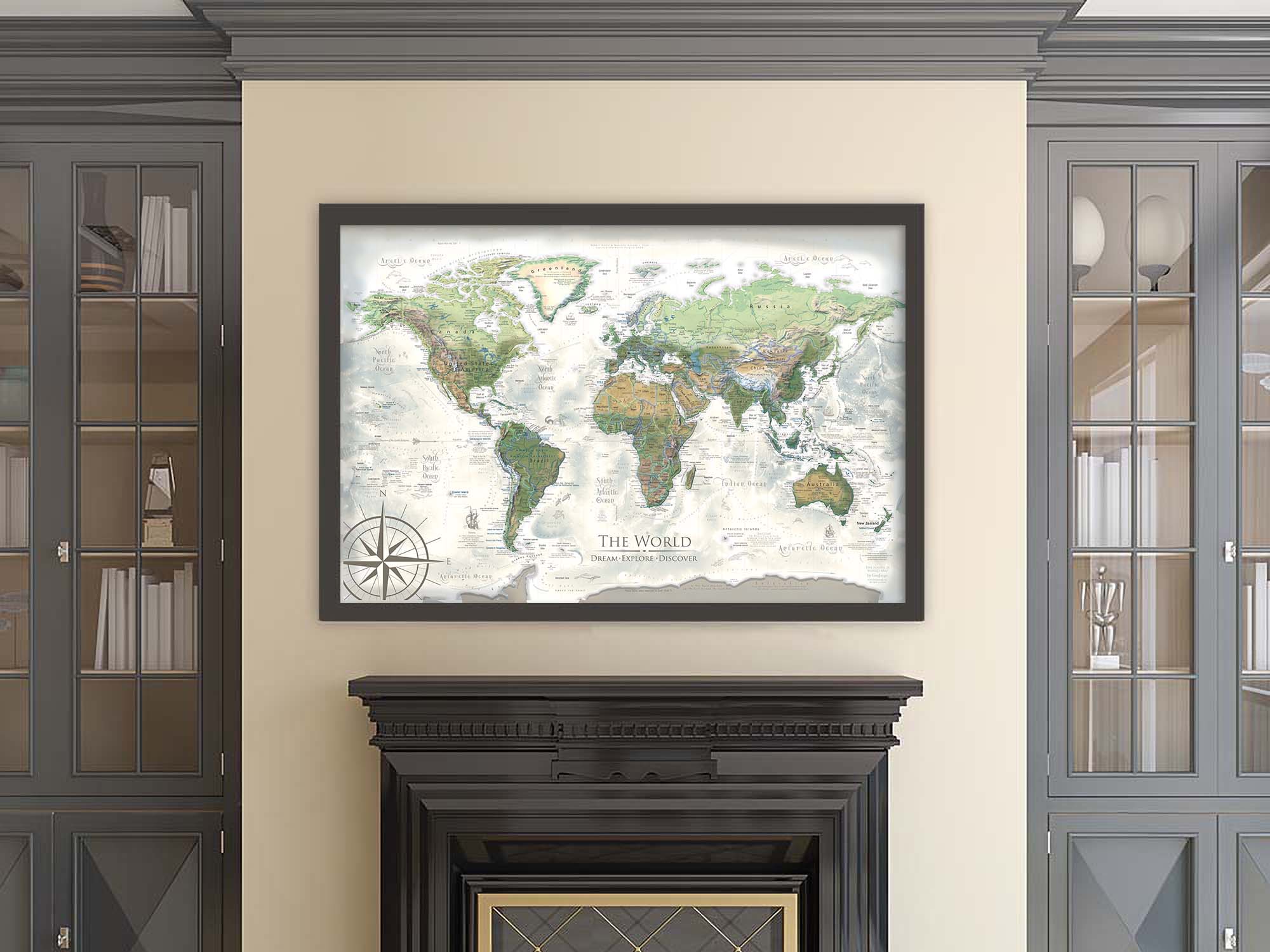
Applications: This World Map is ideal for business, home and offices.
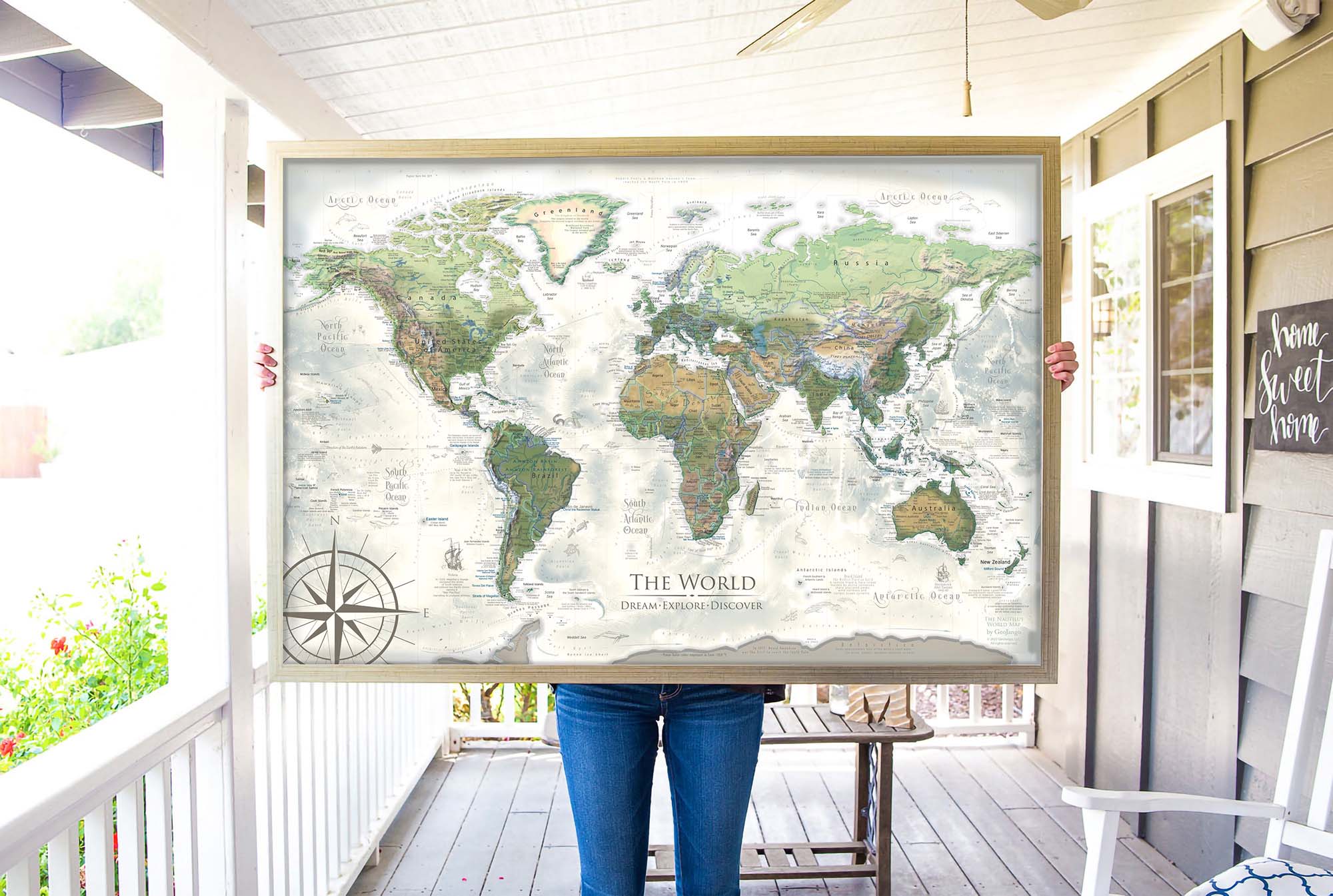
Perspective on Map Size: The map will create a beautiful impression and statement in your space. The larger the map, the more impressive the display. If you love maps, as we do, consider the largest map possible for your space. As a professional geographer, I think displaying a representation of Earth and locations on our planet connects us more with our world and opens up opportunities!
Quality & Happiness Guarantee
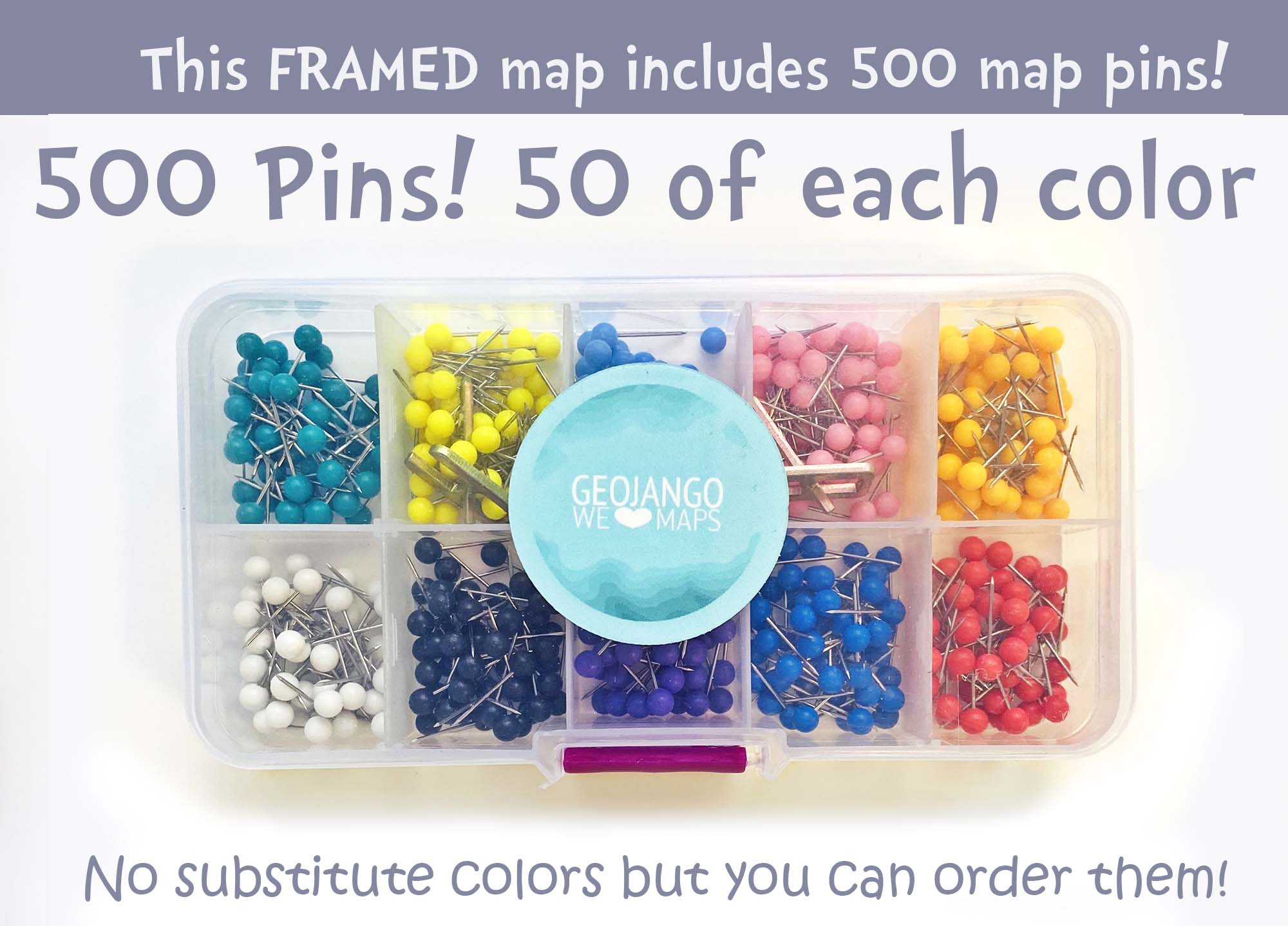
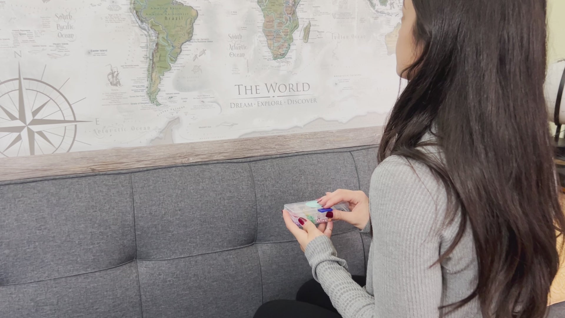
500 Pins Included With Mounted Maps
Made In USA - Pleasanton, CA
Museum Quality Fine Art Production: We have built the finest map production studio in the USA, investing in the best printers and using only archival quality materials! We use specialized printing equipment that produces the finest quality prints to display clear labeling, vivid geography, and oceanography. If you are in the area, come visit us in Pleasanton, California!
Each of our maps are the product of years of research, backed by decades of professional GIS, cartography, and design experience. We keep no stock - every single map we produce is a custom production, made to order just for you. We love personalizing our maps to give you the highest quality experience.
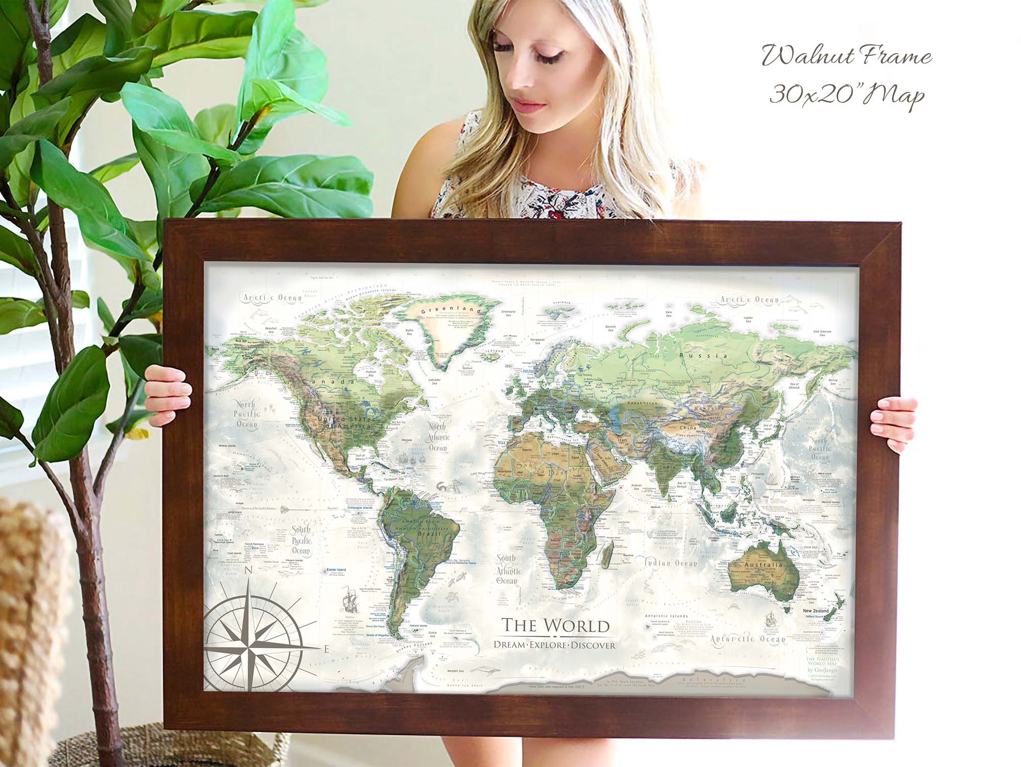
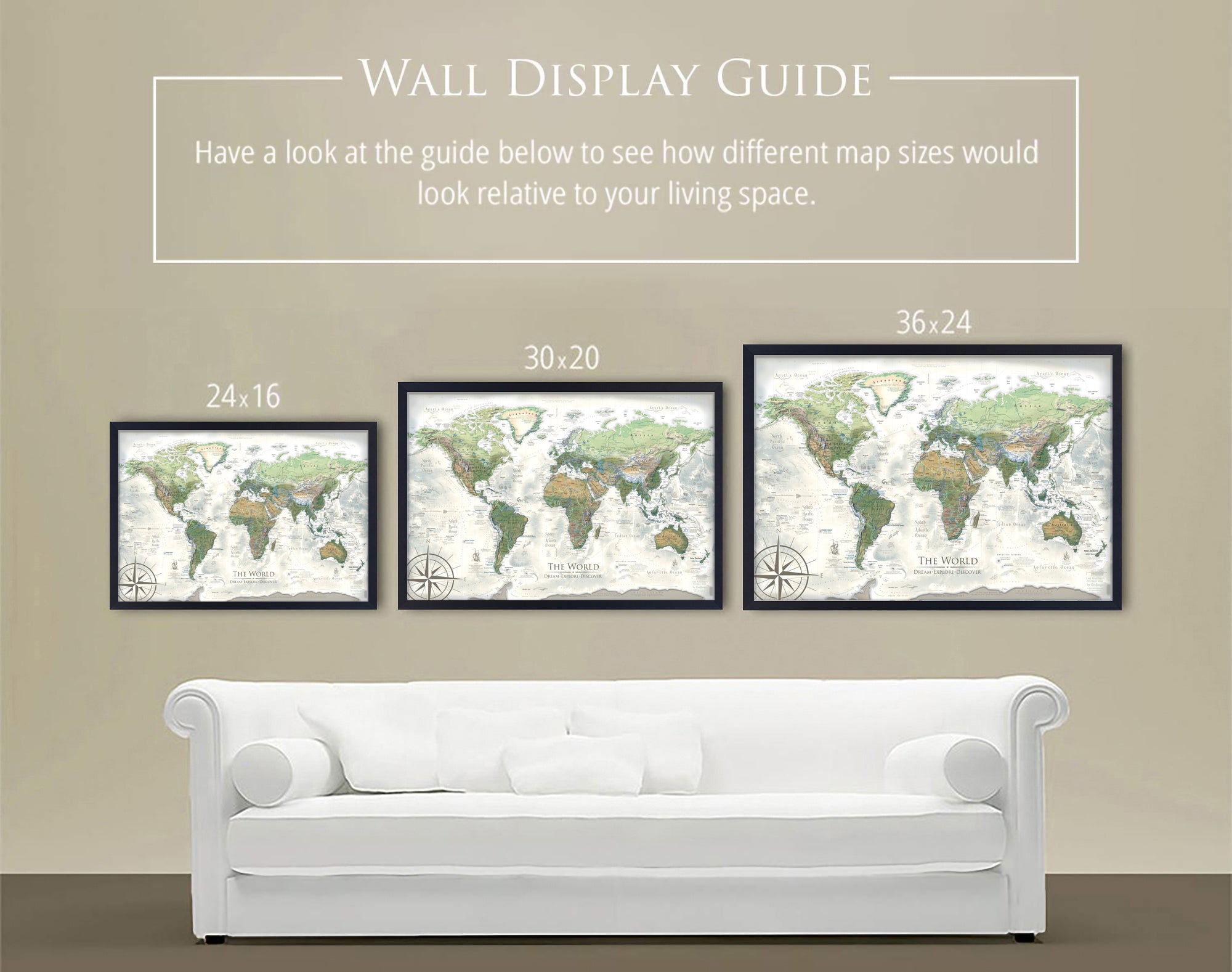
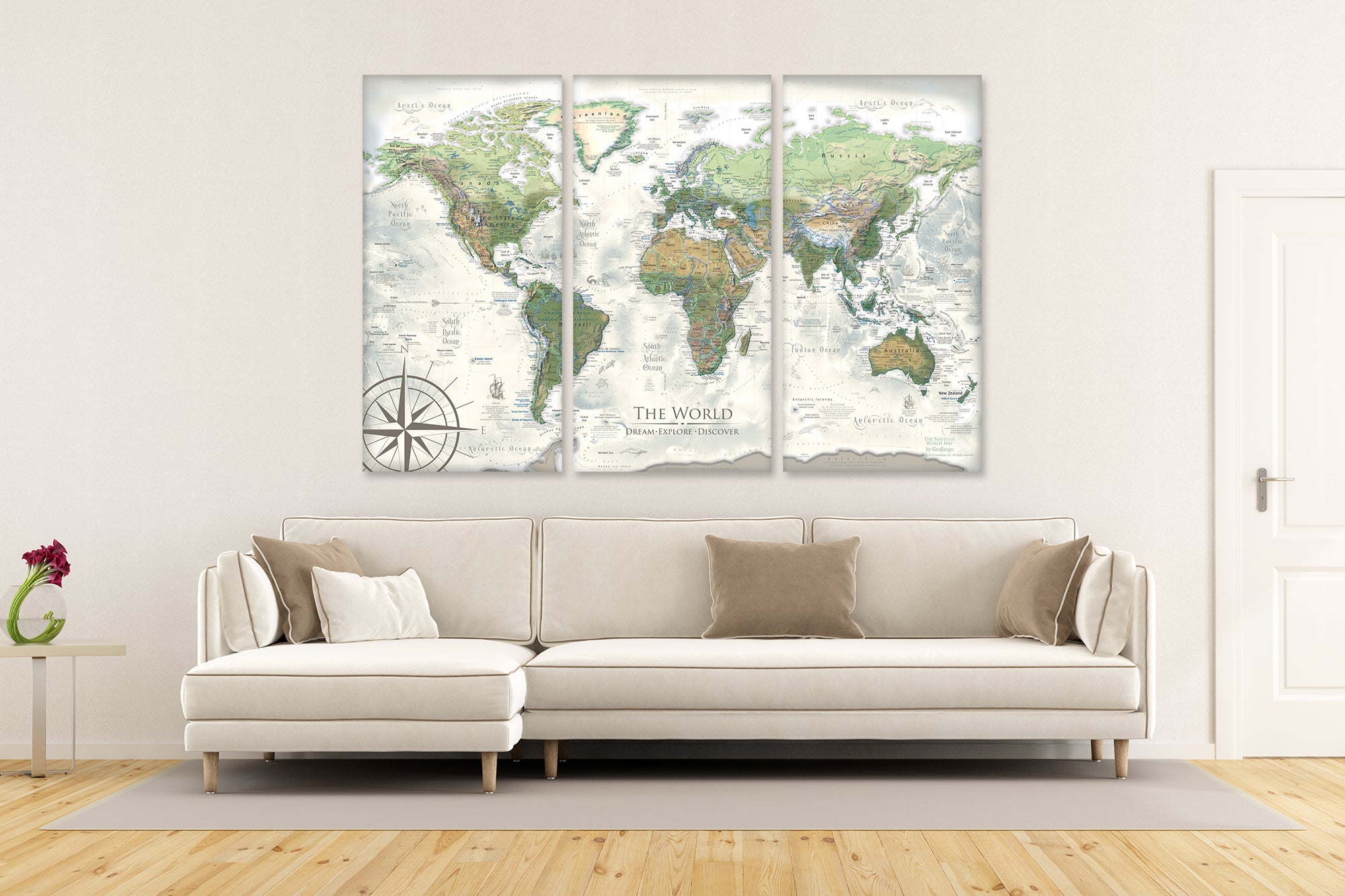
Map Size Selection: The biggest factor in displaying a detailed map is the size. We can produce this map in these sizes: 24x16", 30x20", 36x24", 48x32", 60x40", and 72x48".
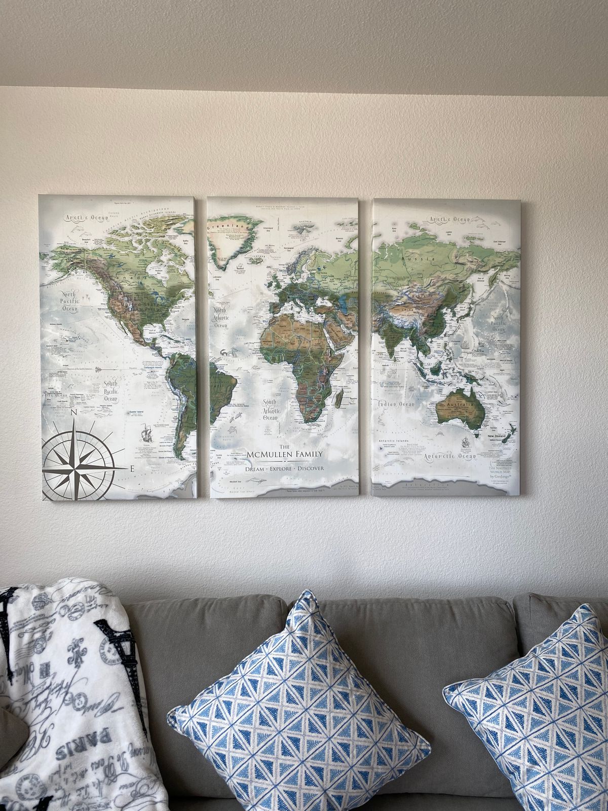
The 60x40" and 72x48" sizes are available as Rolled Prints or as a 3-Panel Canvas Wrap (premium and highest-quality craftsmanship).
The larger the size, the more impressive the display and view of the details in the map.
Need a small USA map that will fit in a limited space, the 24x16" and 30x20" inch size is so charming.
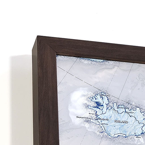
If you will be working with a local framer to display one of our paper or canvas posters in a custom frame, we will be able to accommodate any size between our standard offerings (though not deviating from our 1.5 aspect ratio), and include any margin you specify. Reach out to collaborate.
Framed Map Size vs. Outside Dimensions: Our sizing choices specify the size of the printed map itself. Our frame options will increase the overall size of your final product depending on your selection.
For example:
For specific dimensions, see our page on Map Finish Options
100% Made in the USA by a Small Women-Owned Business. What sets our business apart from most map companies: we are a team of professional Geographers, Cartographers, and Environmental Scientists. We have a passion for making maps and take the profession seriously - to produce beautiful and accurate maps. We apply thousands of layers using GIS and use optimal projections that reduce distortions. Special cartographic features are intricately made on the map and carefully labeled. We include special details that most of our competitors miss - such as real oceanography, accurate projections, and comprehensive labeling and referencing. Our skills and craftsmanship make our makes stand out.
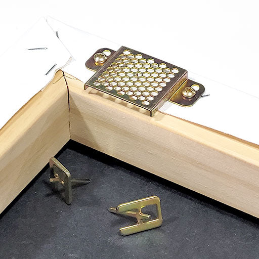
What's Included with a Canvas Wrap or Framed Map: 500 Map pins and pin case. Each push pin map is individually made to order with archival quality materials. The print is mounted to gatorfoam pinboard, which will not warp, bend, or crush like cork or foamcore. We prepare the map with premium hanging hardware so you can start pinning your adventures immediately. This exclusive hanging solution keeps the map stable on your wall, even while pinning where you've been. The map is nicely packaged and shipped in a large box, ready to give as a gift.
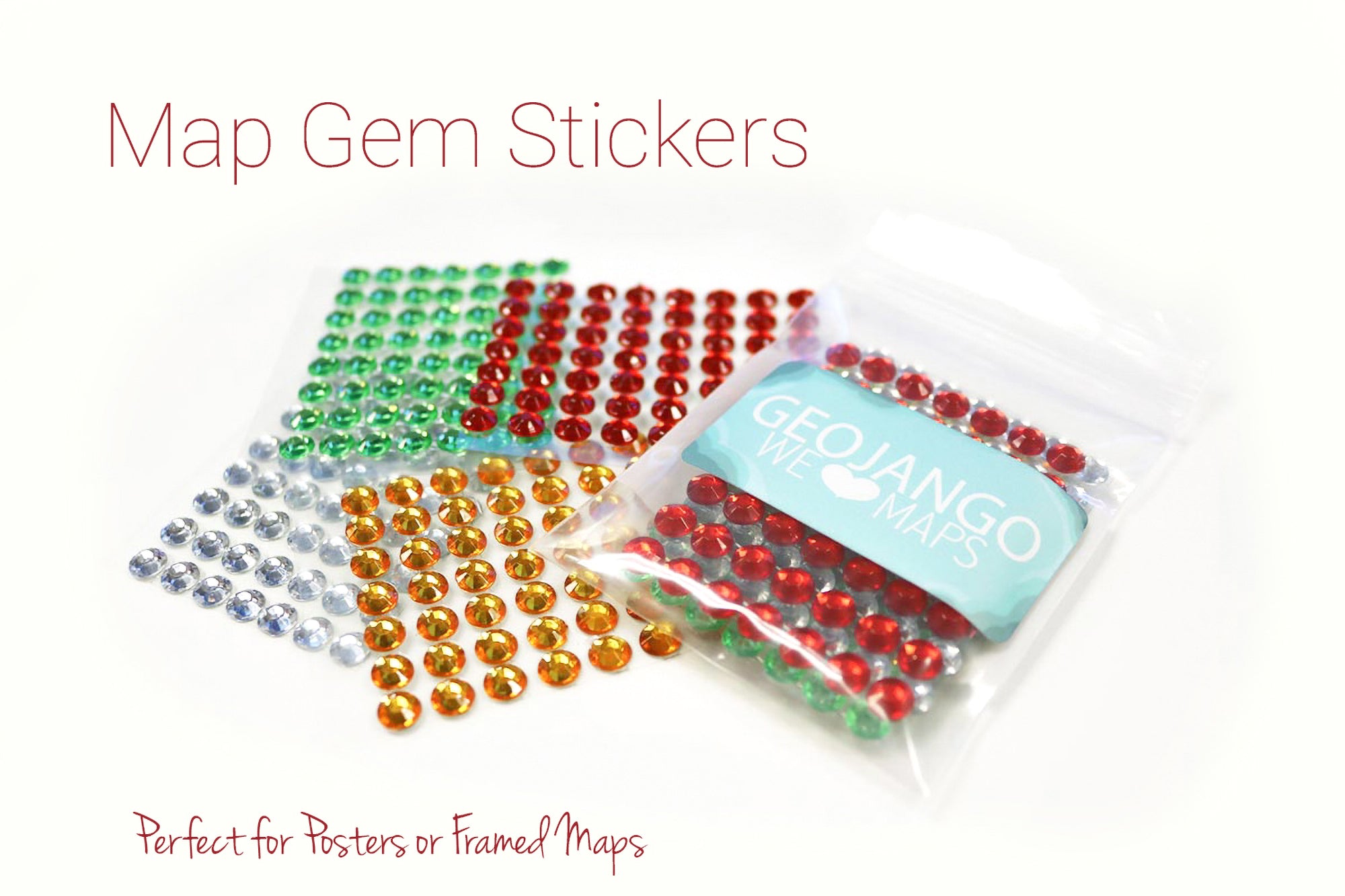
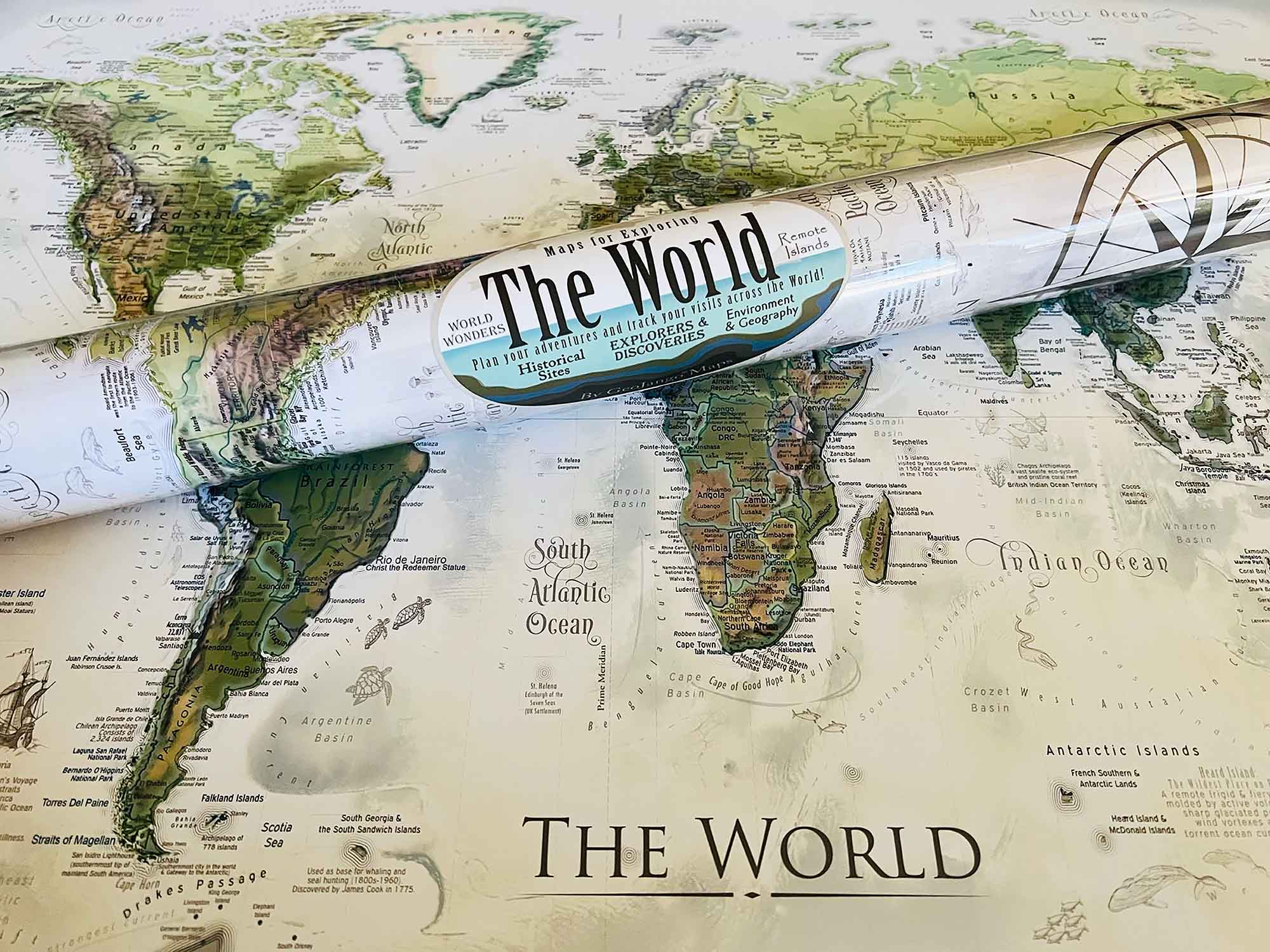
What's Included with a Rolled Poster Map: Pins are not included by default, upon request in your order notes you may write "add pins" or "add gems" depending on your needs, if desired. Consider adding a poster hanging kit to your order if you're not sure how you'll display your poster.
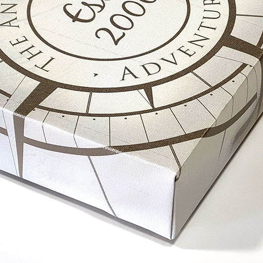
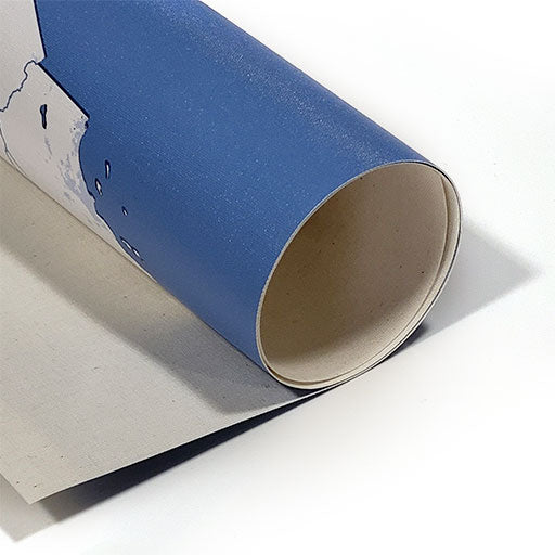
Poster Prints: Each one of our maps is crafted individually, unlike mass-produced alternatives.
Our posters are available in various sizes, all tailored to fit standard frames, we include an additional margin in the print to prevent coverage by the frame's lip. If you intend to DIY a push pin map with one of our posters, be sure to let us know in the order notes to adjust the print margins to your specs. To maintain the map's impeccable condition, it is carefully rolled with a robust tube, eliminating any possibility of folds or creases during transportation.


Our customizations were printed perfectly and my husband loves it.
We did the large three panel world map with some personalizations. I had been looking for a quality push pin map that included national parks for a long time. This map is all that and more. It is absolutely stunning and an added bonus was the scientific details, and little notes you can personalize. The seller was wonderful and quick to answer my questions and create "mock designs" so I could see what it would look like. Highly recommend if you are looking for a quality world map
A wonderful map to enjoy for years!
Great map. Worth the price.

Quality of the product was immaculate and exactly as what was pictured. I couldn't be happier with how it turned out!


