National Parks Map - Track Your USA Travels

Rated 5.0 out of 5
Based on 89 reviews
$39.00

Most orders ship next day!

Standard maps will enter production right away, within the next business day. Larger orders may take more time.

All push pin board maps (framed or canvas wrap) include push pins, are easy to hang, and ship free in the continental US. We'll select the optimal shipping method for fast delivery.

For personalized maps we collaborate closely to guarantee satisfaction. Expect a proof to be sent to you. Your swift responses will facilitate the production and shipping process.

30 day returns.

If there are any problems with your map we will take care of you. Returns for all maps are straightforward and hassle-free.

For personalized maps, engaging with the email proofs we send ensures that the final product meets your expectations precisely.

We have 30+ years of cartography experience, meticulously craft each order by hand to ensure excellence, and 100% guarantee your satisfaction. We produce maps that are built to last, with state of the art production and archival quality materials.

Personalize Your Map

Customize with quotes, legends, or dedications using "Personalize Map" options to craft your masterpiece map. Or reach out to us if you don't see the option you want.

We collaborate with you from design to approval of your proof so that you are 100% happy before we print and ship.

Our excellent customer service is always open to you.

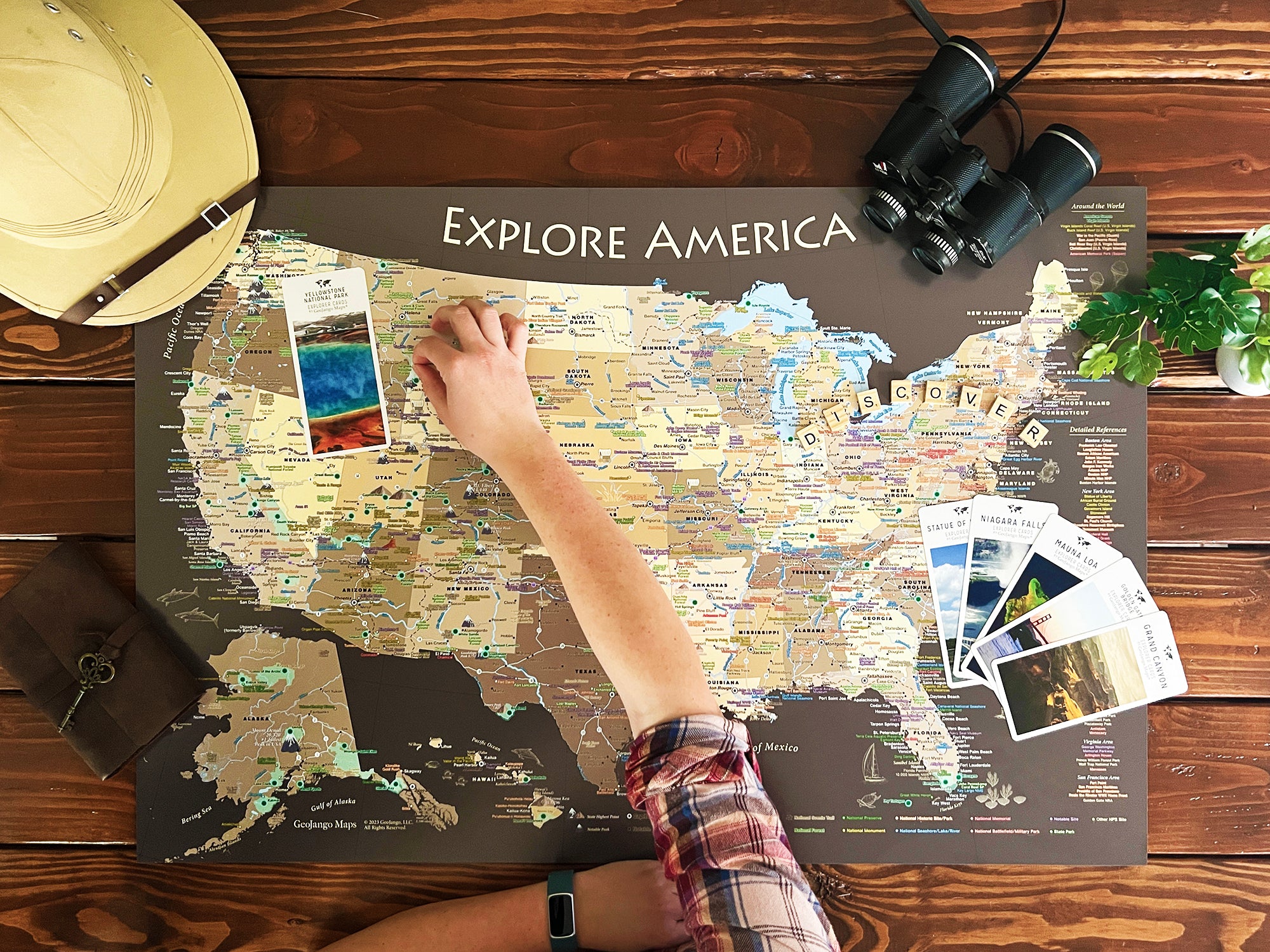
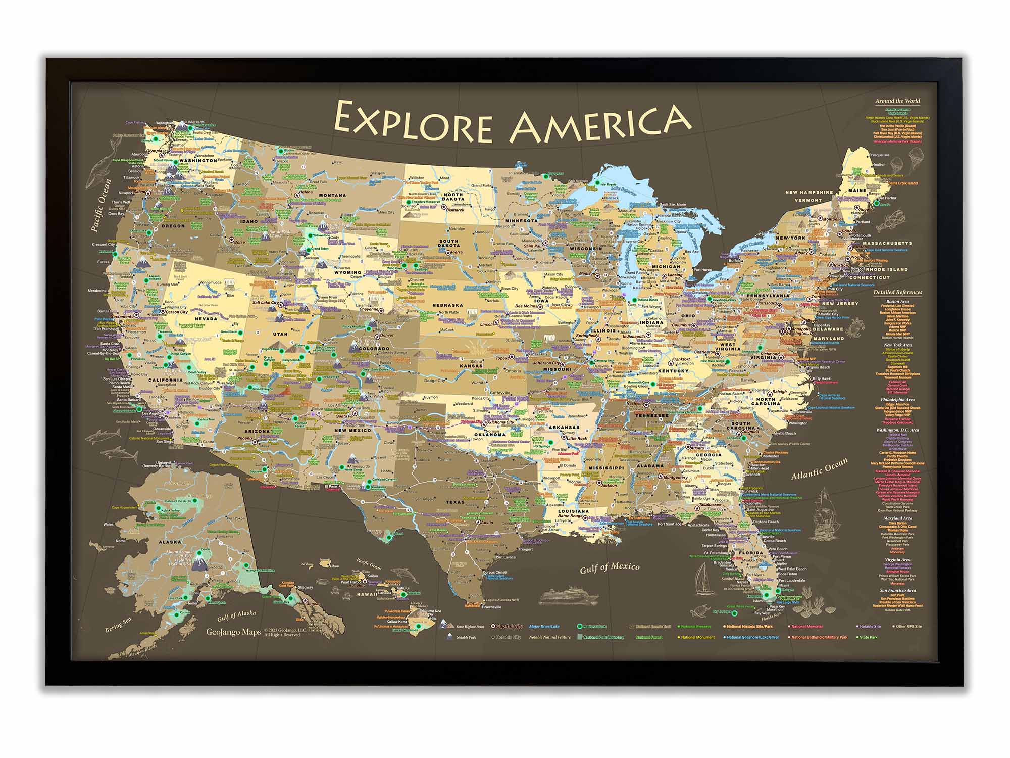
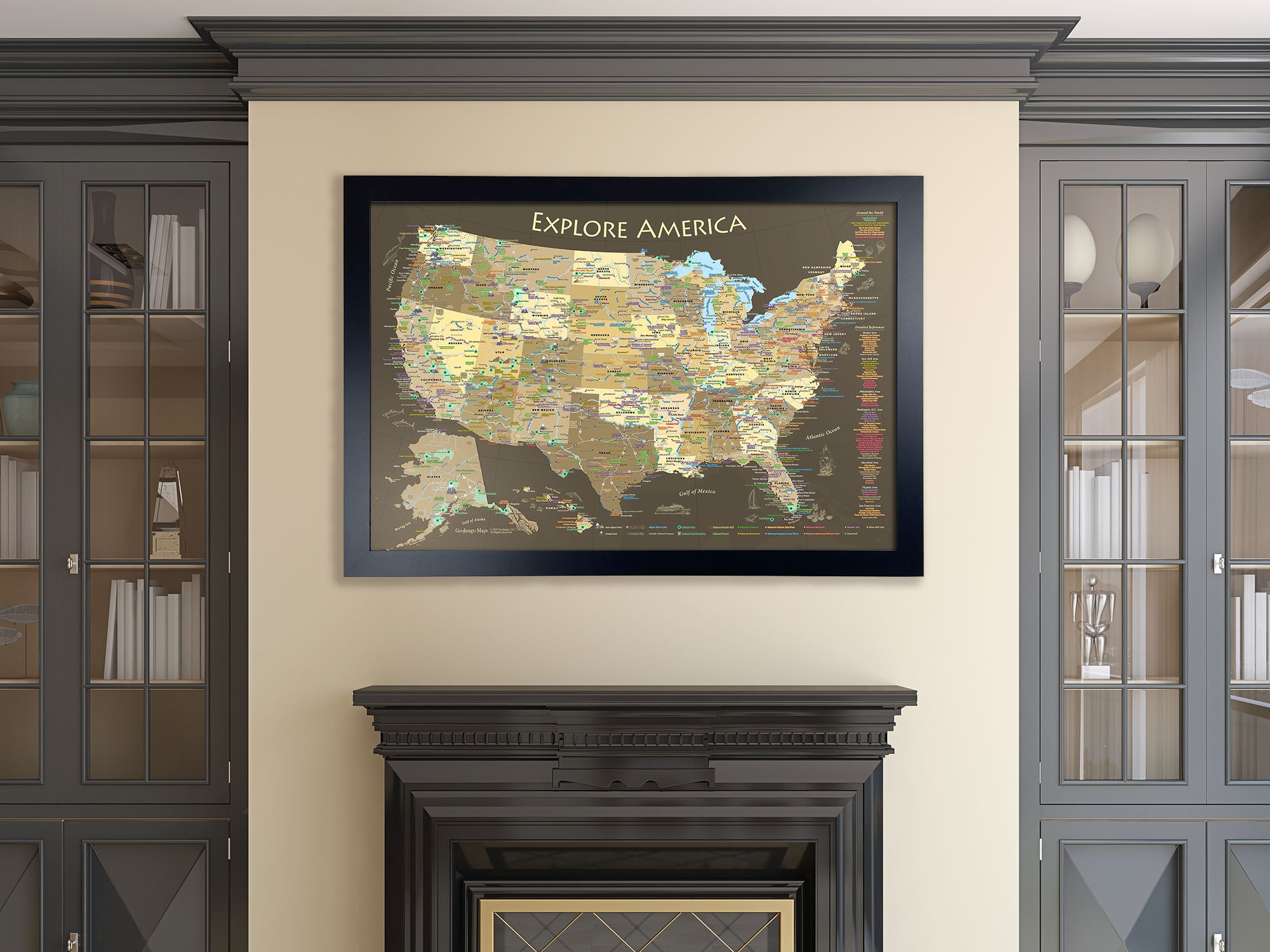
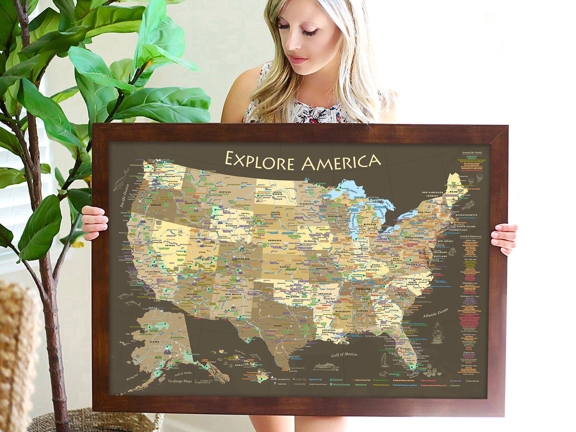
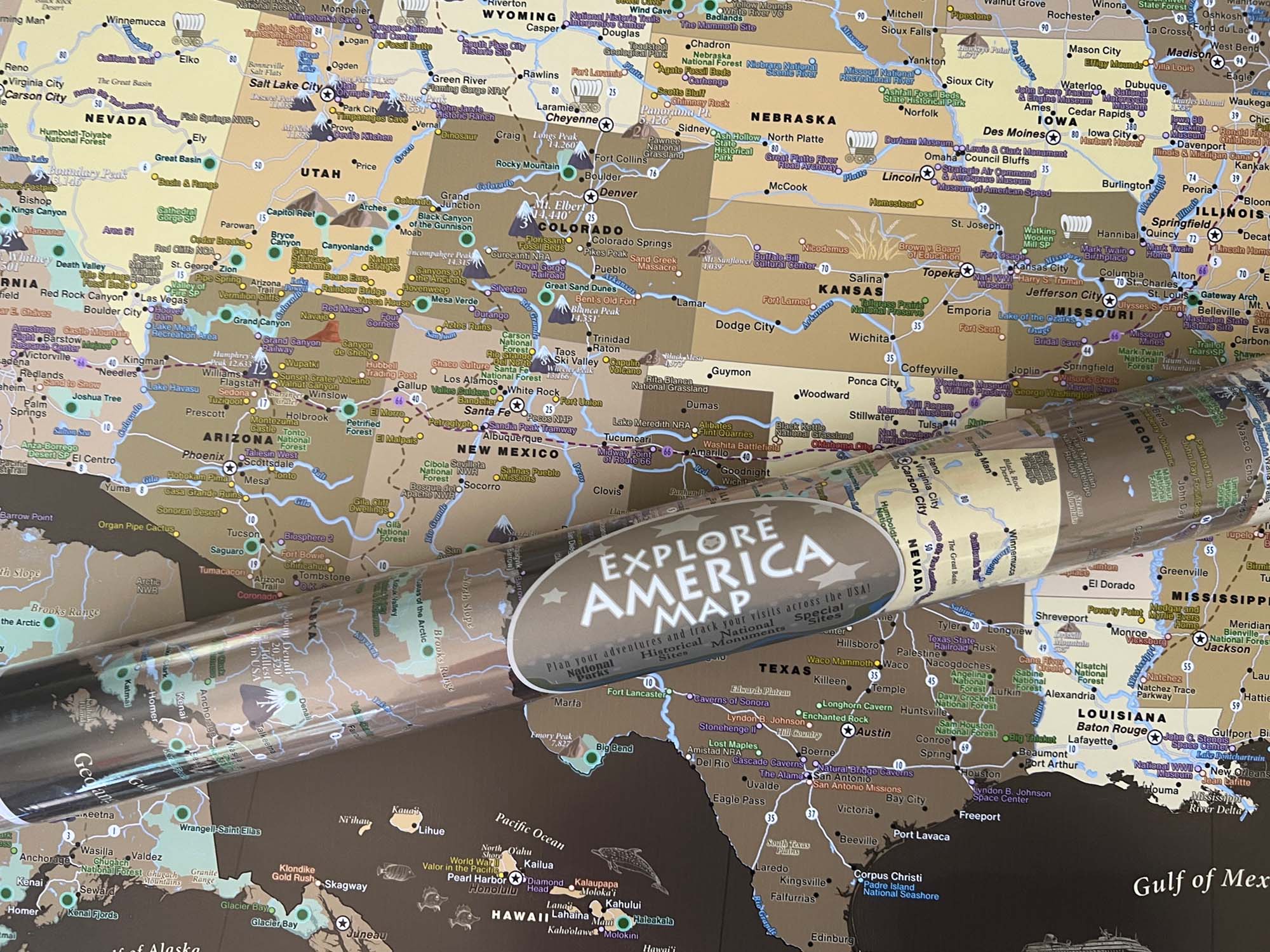
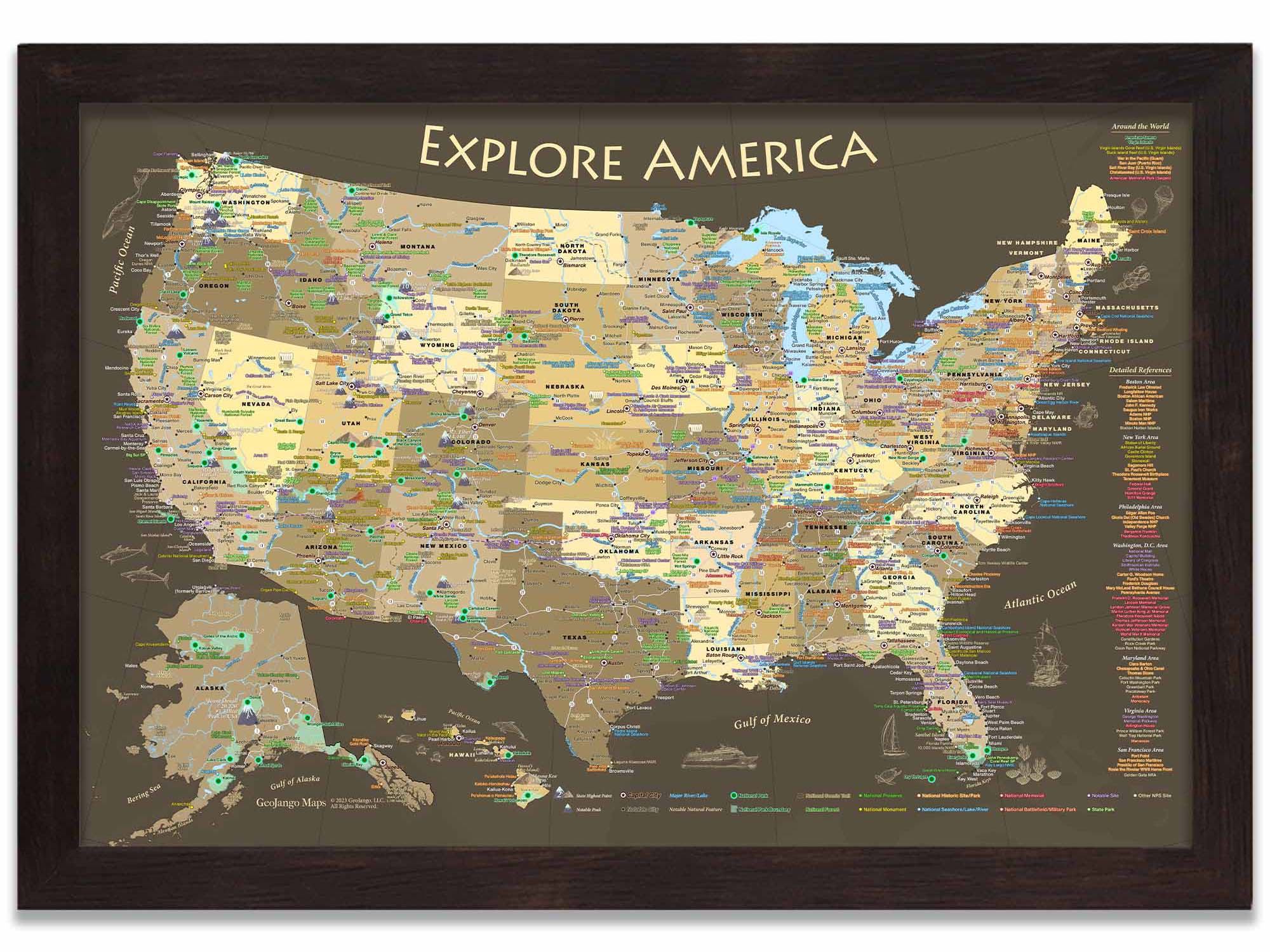
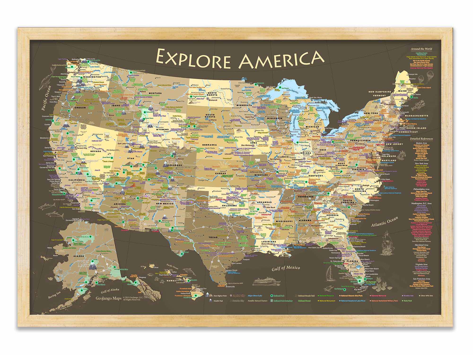
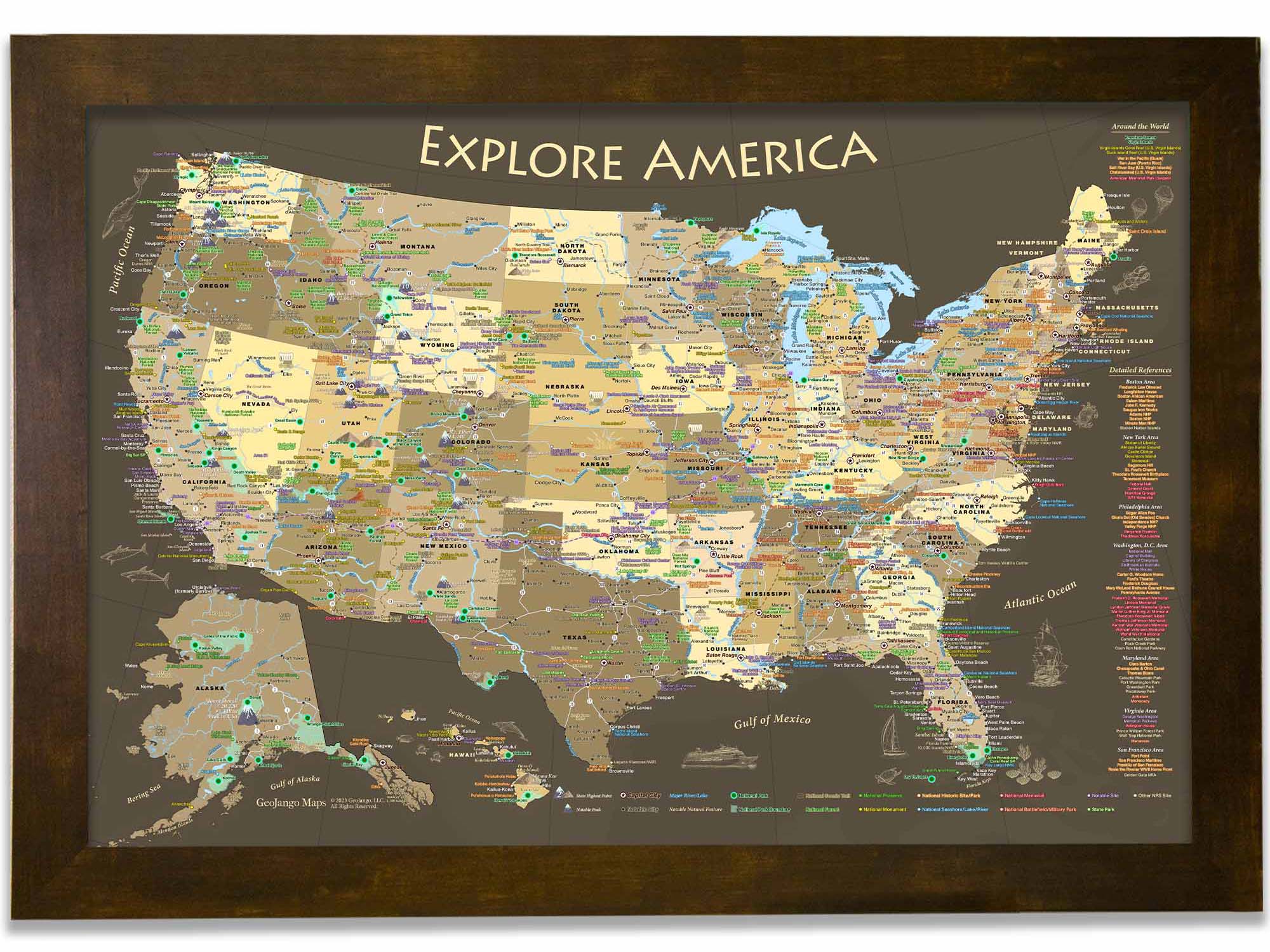
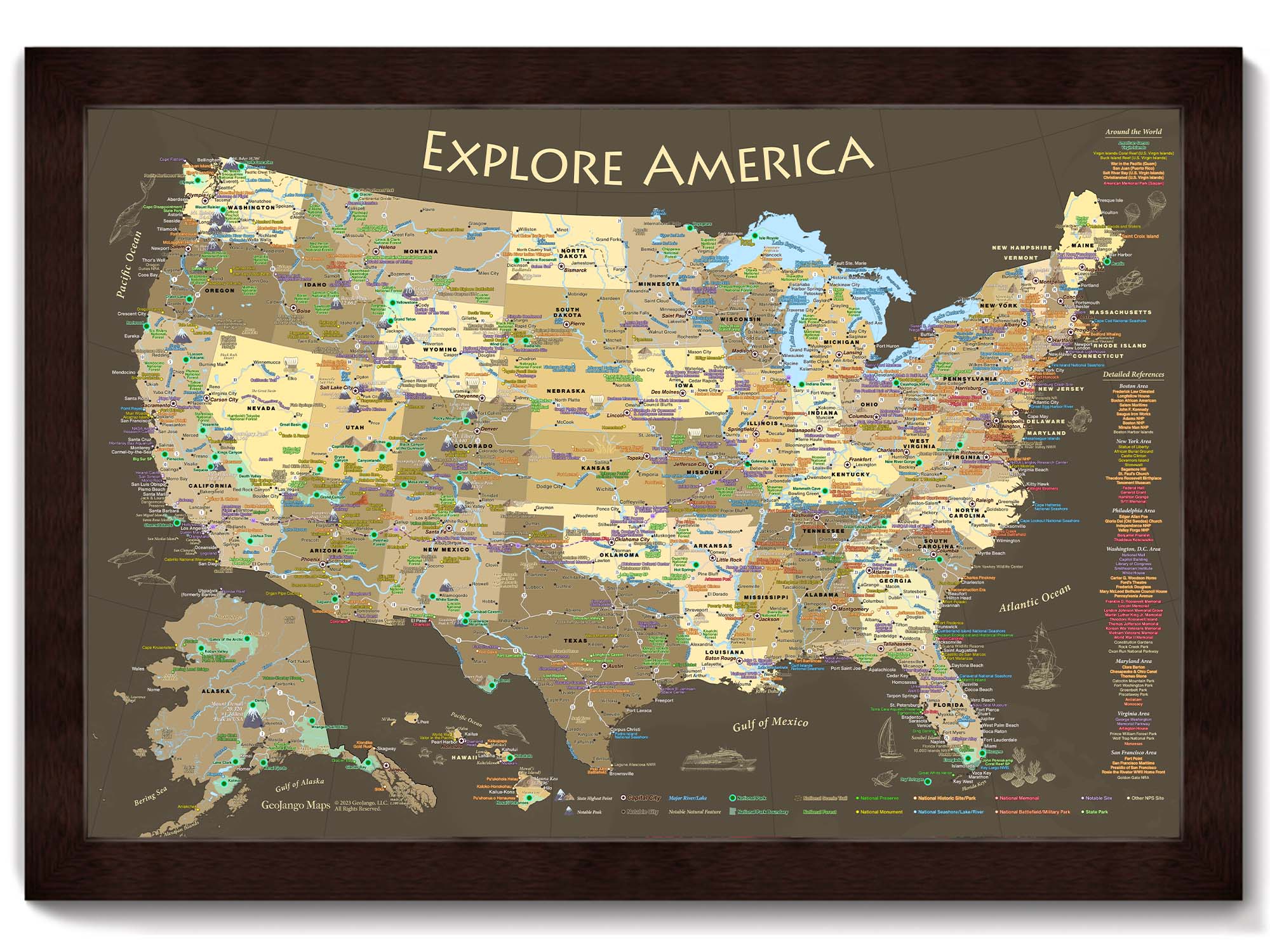
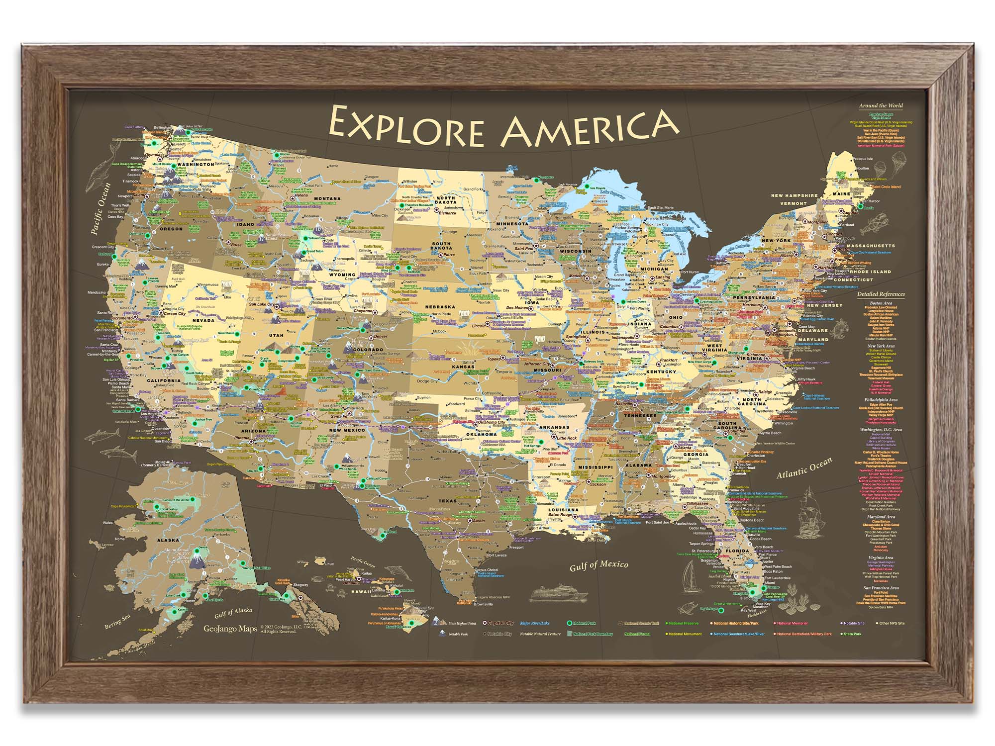
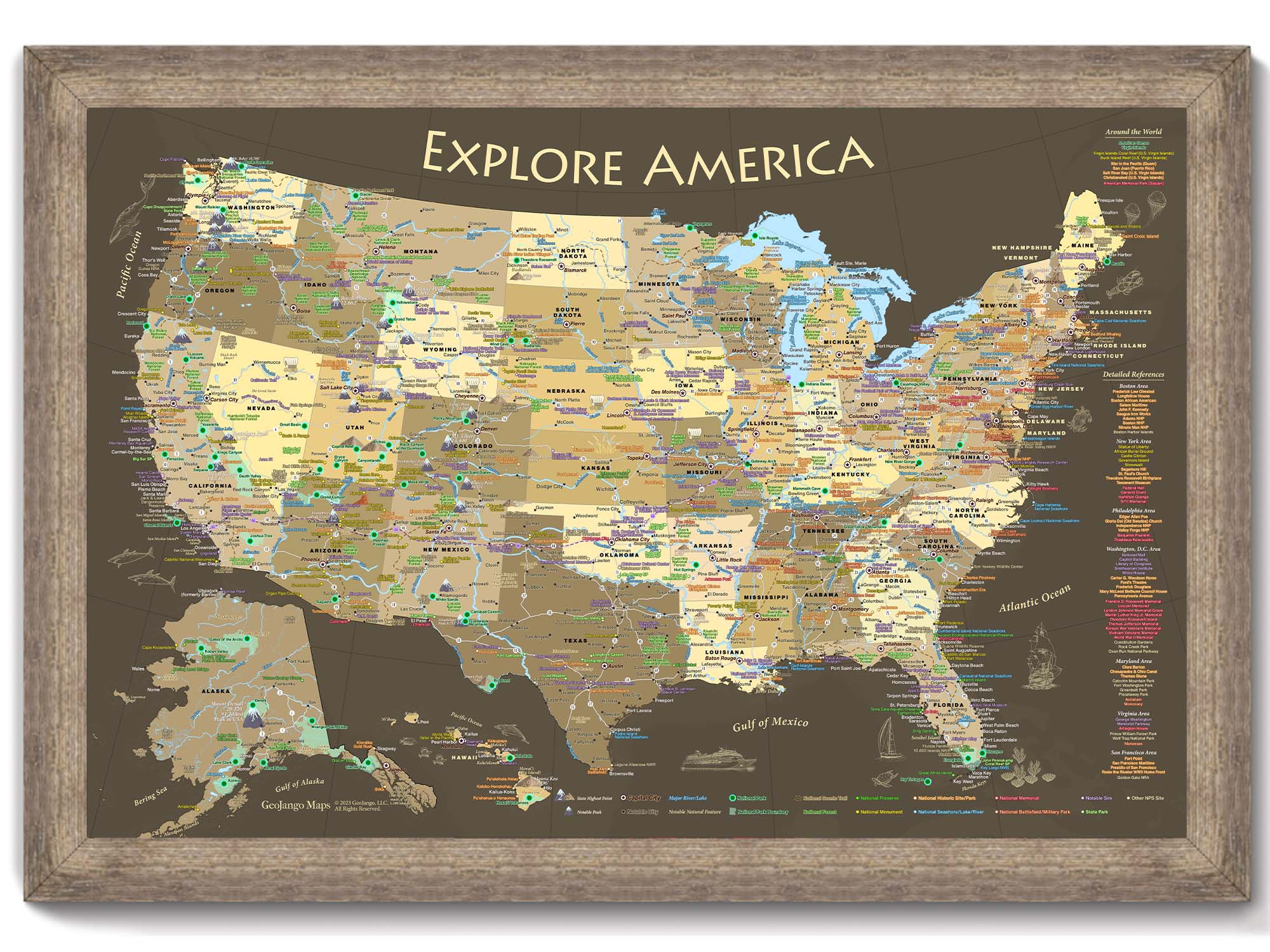
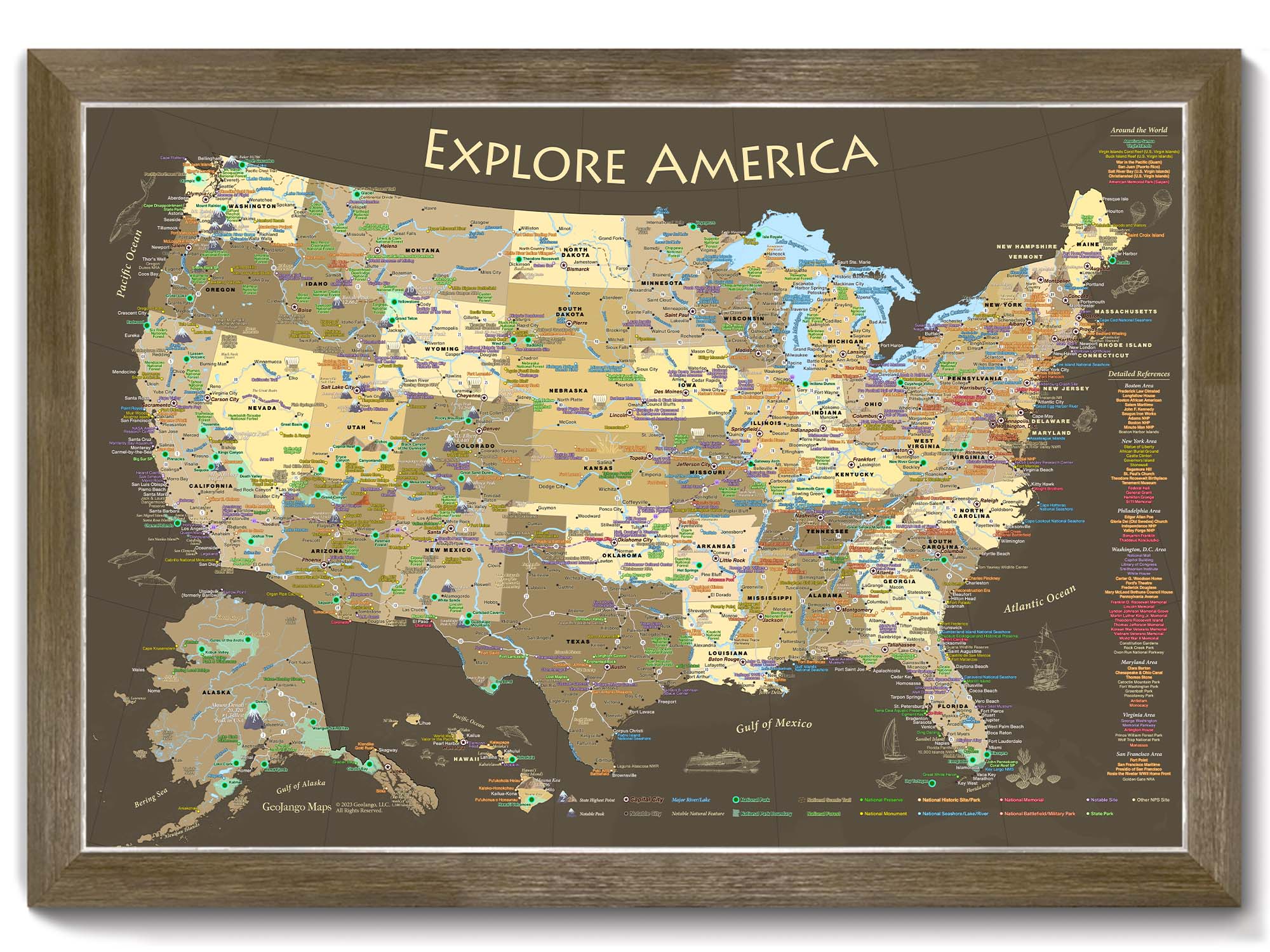
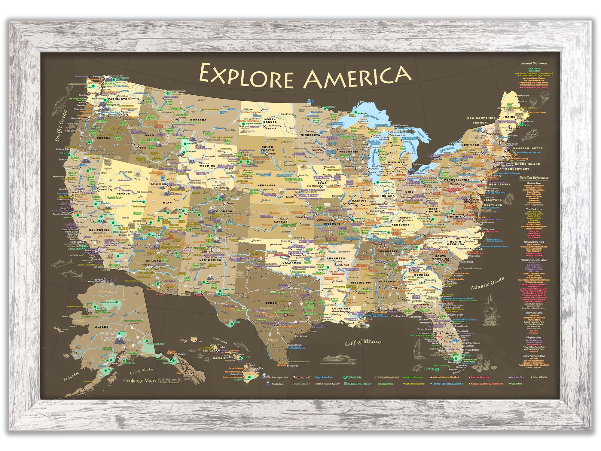
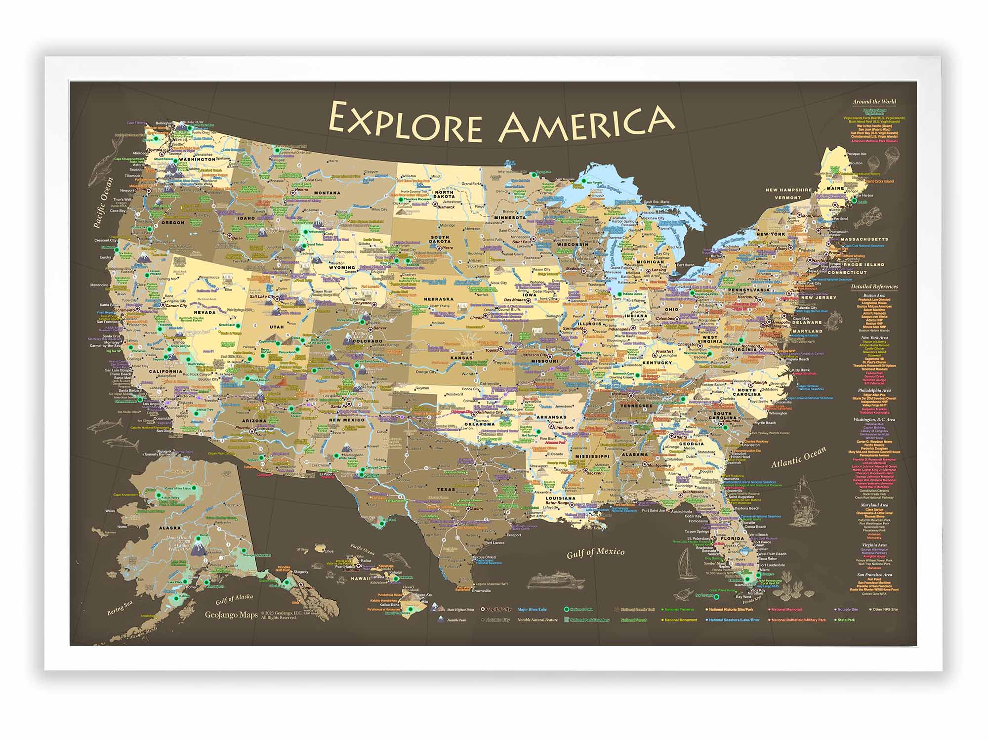
USA National Parks Map:

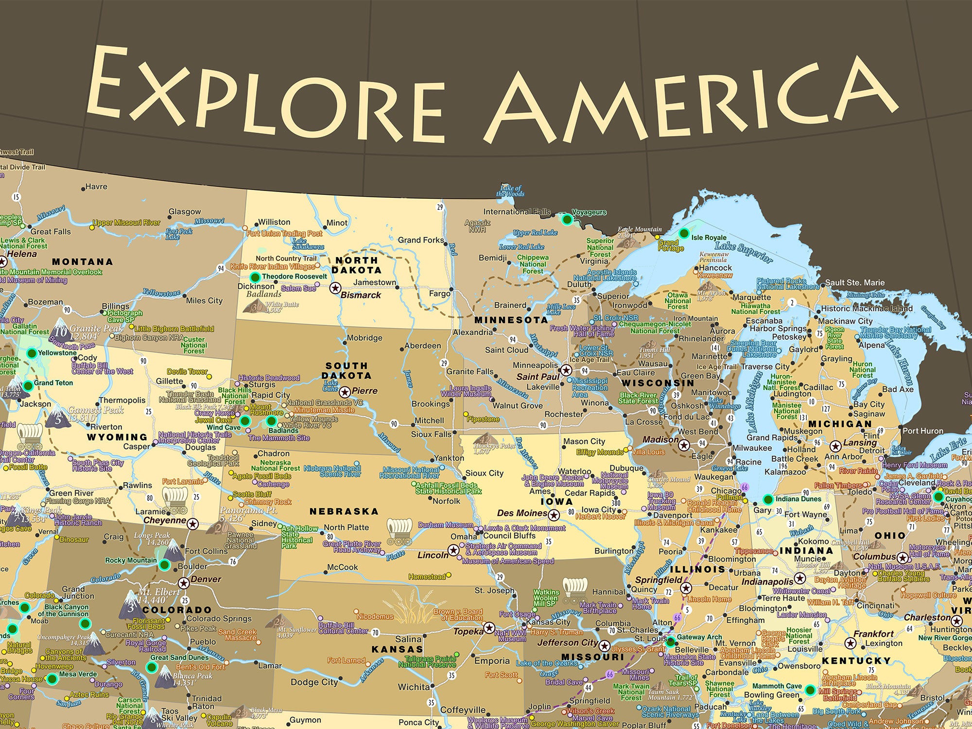
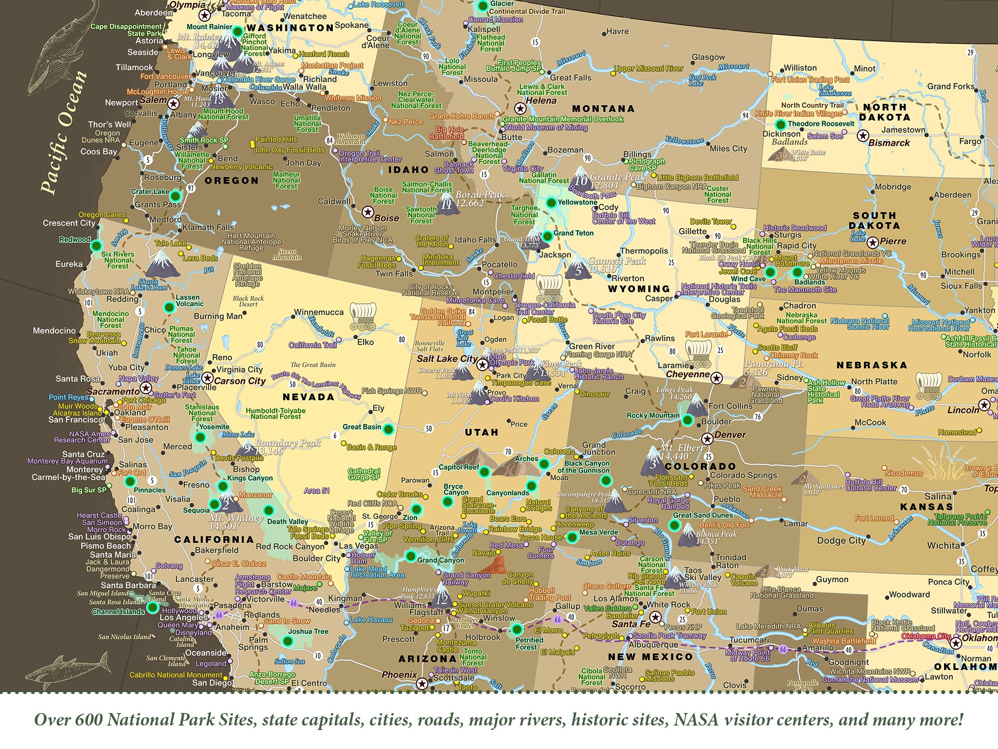
Embark on a breathtaking journey across the United States with our exquisitely detailed map. Designed for explorers at heart, this map is your gateway to adventure, allowing you to track your travels, discover hidden gems, and immerse yourself in the natural beauty and history of over 600 national park sites. This comprehensive map not only showcases landmarks in all 50 states and their capitals but also integrates a detailed network of U.S. interstates to help you plan your journey seamlessly.

This map not only guides your exploration but also enriches your journey with captivating details about the geography and storied past of the USA, making each trip a learning adventure.

Discover the tallest peaks of each state, and follow the meandering paths of major rivers. Dip your toes into the iconic lakes and expansive water bodies as our map leads you through a treasure trove of geographical wonders and historical tales from across the USA.

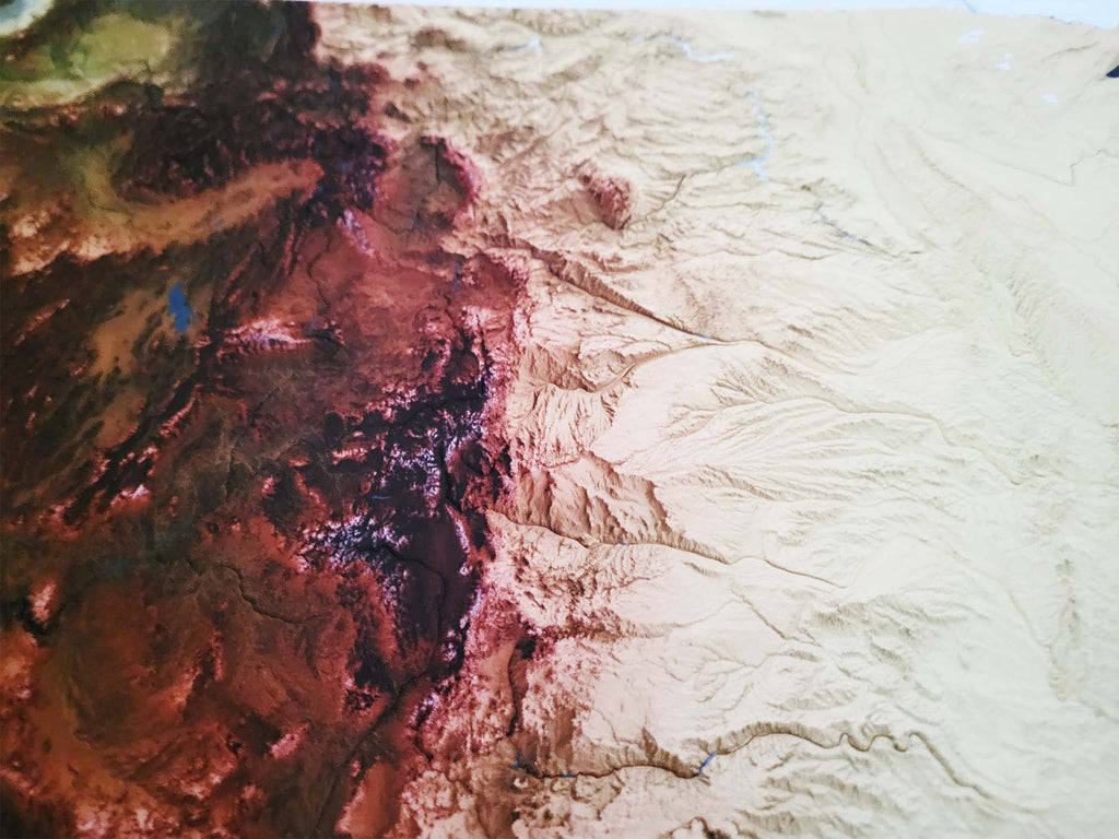
Cartographic Details: Crafted with precision using advanced GIS technology, our map combines authoritative data from sources like the National Parks Service and USGS, presented through stunning cartographic designs. The result is a visually striking and accurate portrayal of the U.S. landscape. 

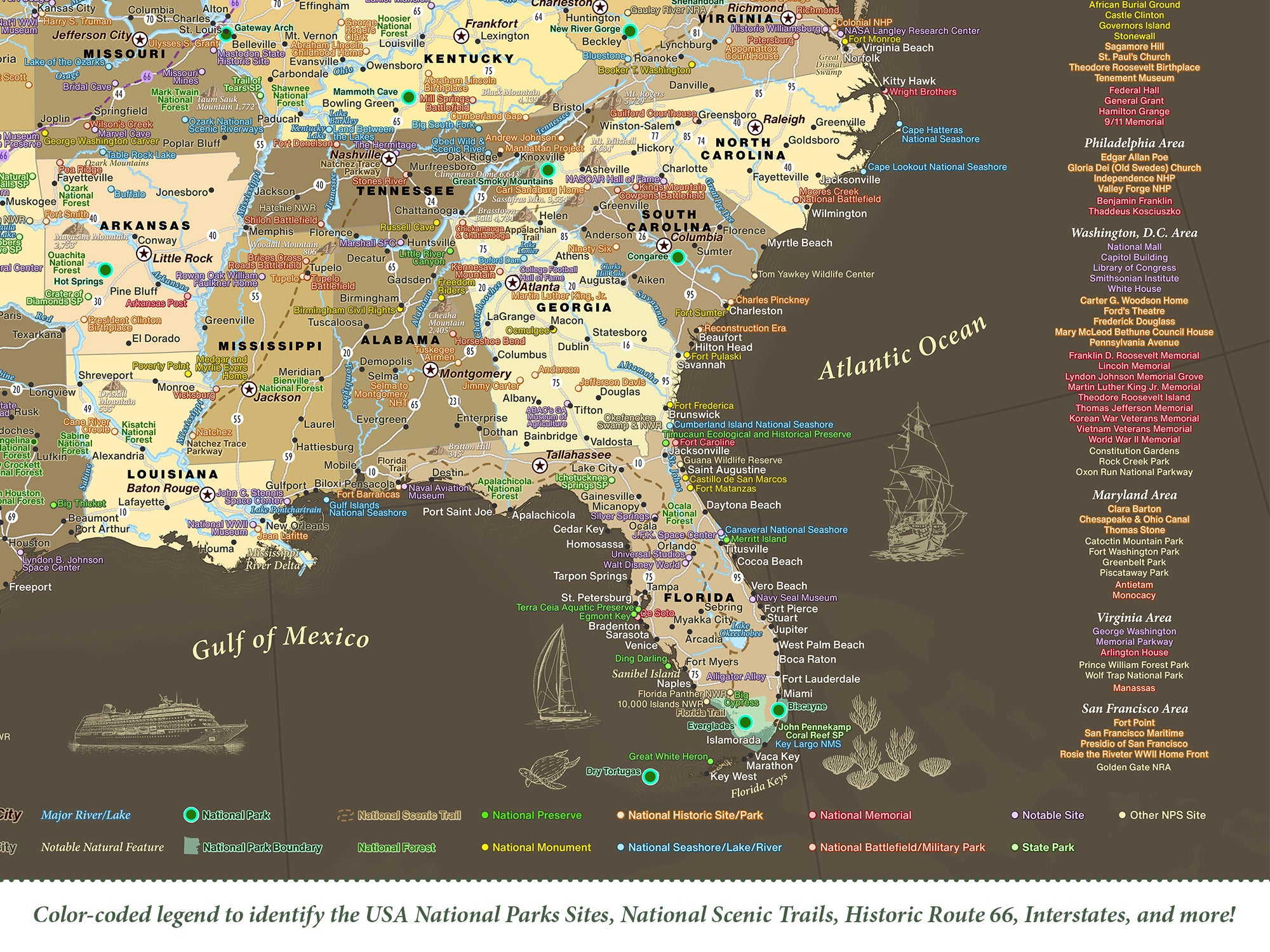
Map Legend: Reference the color-coded locations in the map with the legend key on the bottom right, something very unique and a valuable tool. 

Adventure Travel Gift: Perfect for educators, adventurers, history lovers, and map lovers, our map offers a unique blend of educational value and travel planning utility. 

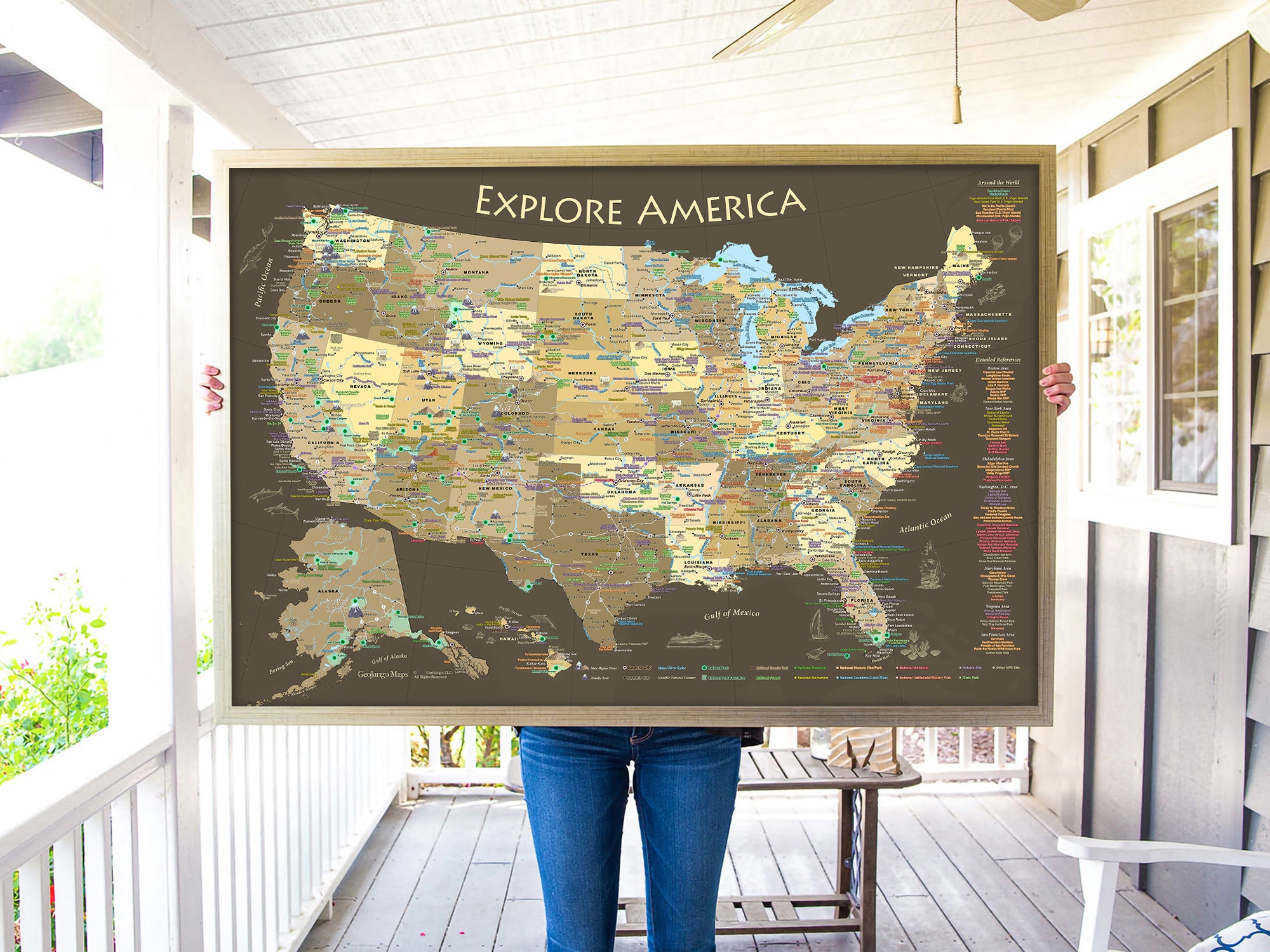
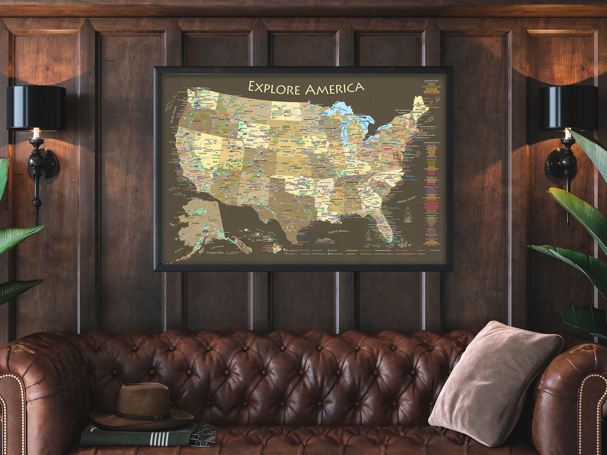
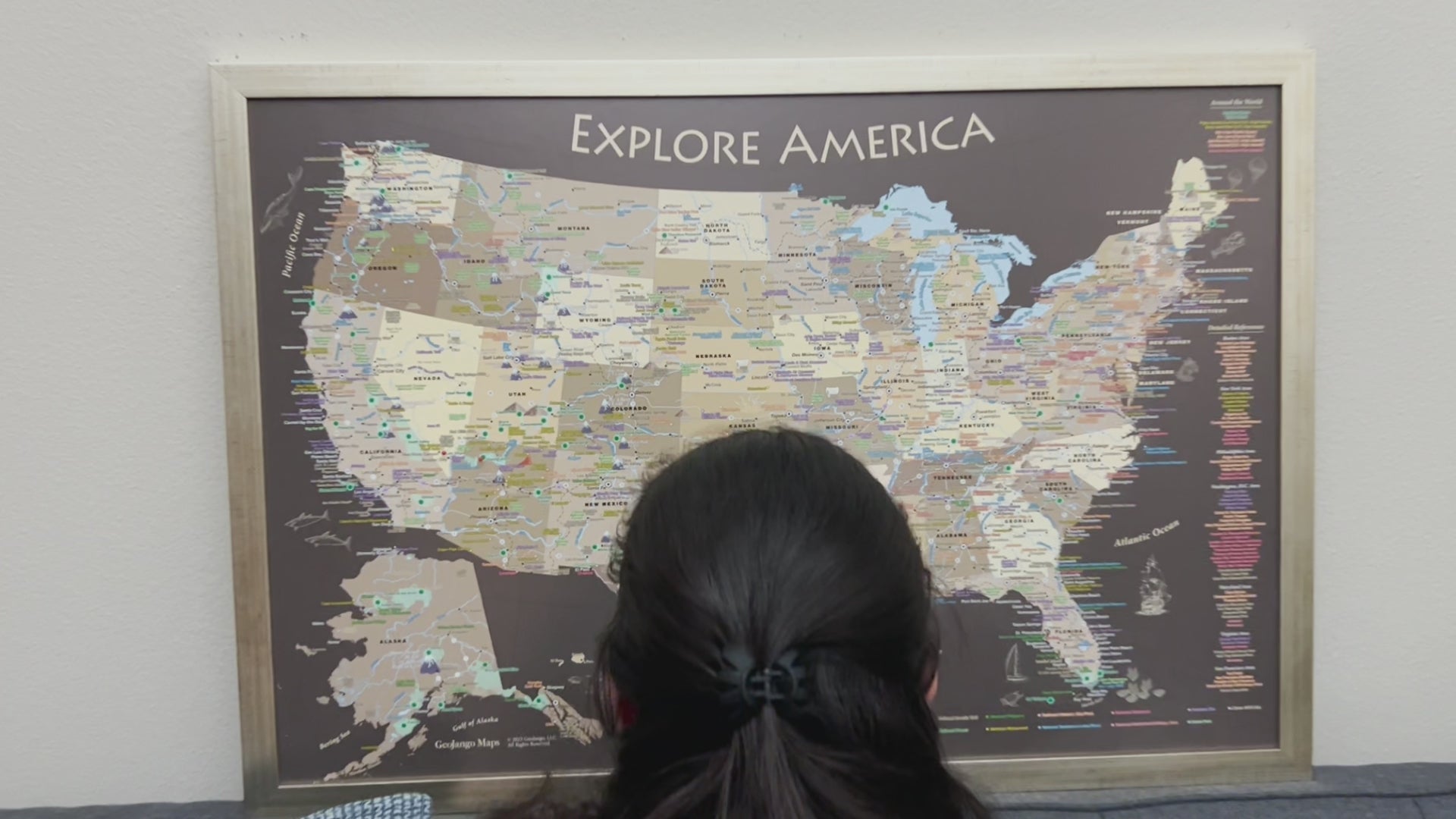
A Picture of the USA: The map can be used as a push pin map or as a beautiful display.  Either way, it illustrates the story of the USA! 

What sets this map apart from all others: Experience Alaska like never before with our unique USGS projection that showcases the true shape of the state. Plus, our careful mapping respects the natural curves of the continental U.S., presenting a more accurate view than most maps offer. Reference detailed labeling to discover hidden gems and fascinating facts about America.
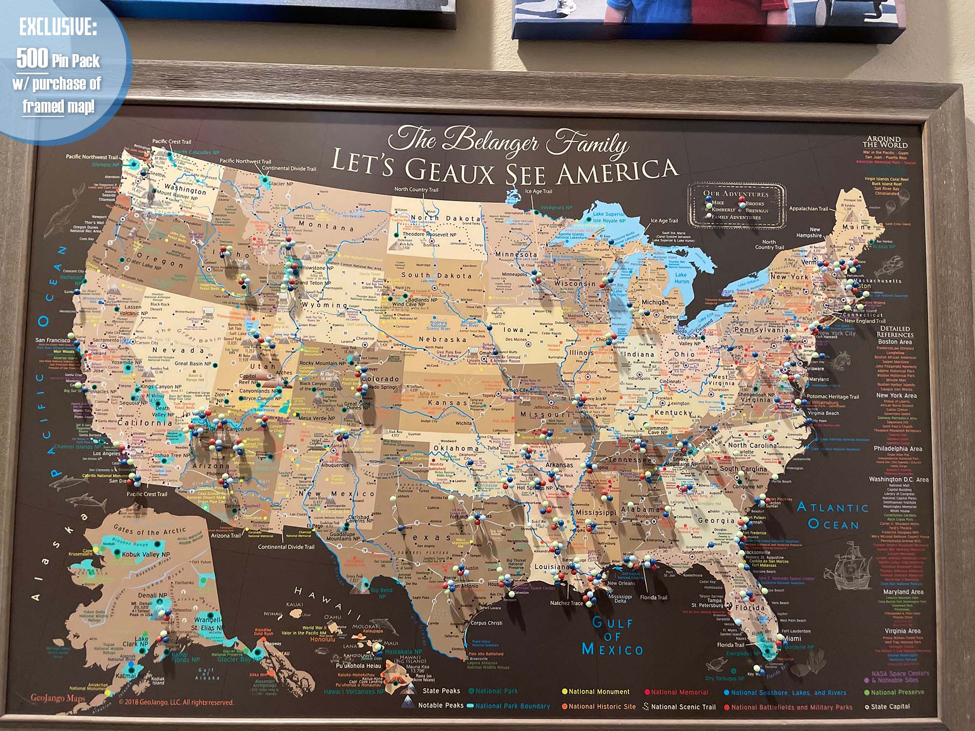
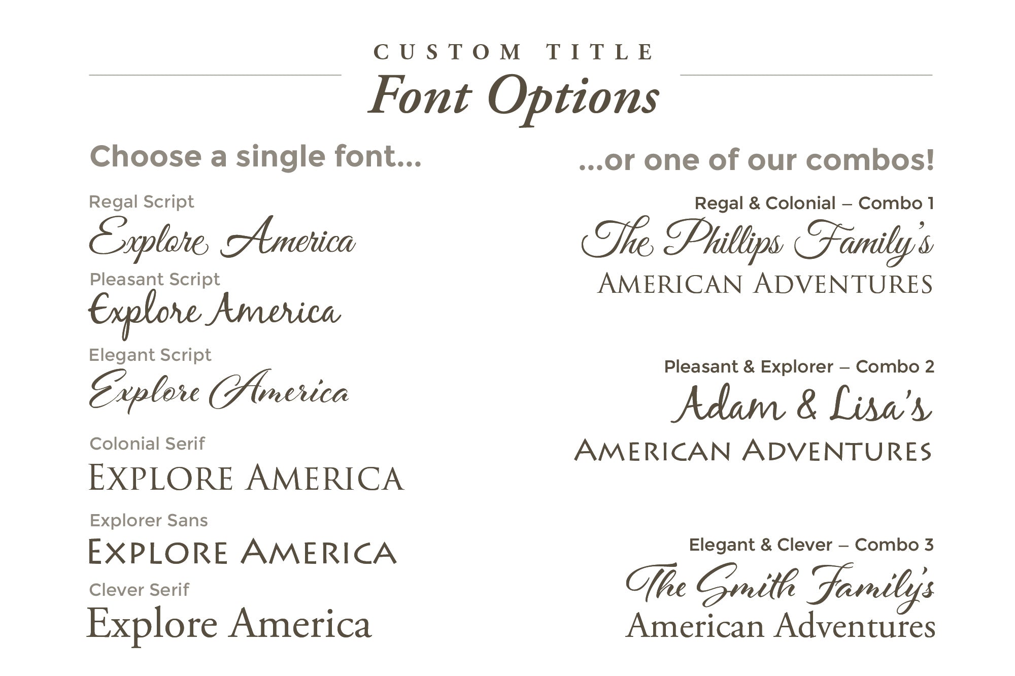
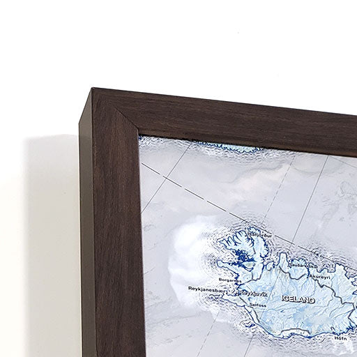
Personalized Map Options Make it yours! Customize your map with a personal title, subtitle, and legend to make it truly unique. Simply enter your details in the ' Personalize Map and Custom Title' section, and we’ll prepare a proof within 24 hours (weekdays), ensuring your map perfectly matches your vision.

Key Map Features:
✦ Political-style map, emphasizing state boundaries
✪ Detailed cities, USA capital, & state capitals
✦ USA Interstates
✦ Major rivers, lakes, & oceans
✪ National Parks, Forests, Preserves, Scenic Trails, & Recreation Areas
✪ National Historic Sites, Battlefields, & Memorials
✦ Significant locations & historical cities
▲ The tallest point of elevation in every state - from Florida to Alaska!
▲ Top 10 Mountain Peaks (notable and most climbed)

A Special Note: this map is a work of art, passion, and dedication.  We built it for you to learn more about the USA: Venture out and explore America! 


"'This map not only decorated our classroom but also inspired our history club’s summer road trips”, says Jordan Miller, a history teacher and adventurer in Idaho.


Quality & Happiness Guarantee

500 Pins Included With Mounted Maps

Made In USA - Pleasanton, CA

Specs & Construction

Museum Quality Fine Art Production: We have built the finest map production studio in the USA, investing in the best printers and using only archival quality materials! We use specialized printing equipment that produces the finest quality prints to display clear labeling, vivid geography, and oceanography. If you are in the area, come visit us in Pleasanton, California!

Each of our maps are the product of years of research, backed by decades of professional GIS, cartography, and design experience. We keep no stock - every single map we produce is a custom production, made to order just for you. We love personalizing our maps to give you the highest quality experience.

Map Size Selection:  The biggest factor in displaying a detailed map is the size. We can produce this map in these sizes: 24x16", 30x20", 36x24", 48x32", 60x40", and 72x48".  

The 60x40" and 72x48" sizes are available as Rolled Prints or as a 3-Panel Canvas Wrap (premium and highest-quality craftsmanship).

The larger the size, the more impressive the display and view of the details in the map.

Need a small USA map that will fit in a limited space, the 24x16" and 30x20" inch size is so charming.

If you will be working with a local framer to display one of our paper or canvas posters in a custom frame, we will be able to accommodate any size between our standard offerings (though not deviating from our 1.5 aspect ratio), and include any margin you specify. Reach out to collaborate.

Framed Map Size vs. Outside Dimensions: Our sizing choices specify the size of the printed map itself. Our frame options will increase the overall size of your final product depending on your selection.

For example:

  • Maps sized 24 x 16 inches will total 26.5 x 18.5 inches with the frame
  • Maps sized 30 x 20 inches will total 34 x 24 inches with the frame
  • Maps sized 36 x 24 inches will total 40 x 28 inches with a selection of a 2-inch frame
  • Maps sized 48 x 32 inches will total 52 x 36 inches with a selection of a 2-inch frame

For specific dimensions, see our page on Map Finish Options

100% Made in the USA by a Small Women-Owned Business.  What sets our business apart from most map companies: we are a team of professional Geographers, Cartographers, and Environmental Scientists. We have a passion for making maps and take the profession seriously - to produce beautiful and accurate maps. We apply thousands of layers using GIS and use optimal projections that reduce distortions. Special cartographic features are intricately made on the map and carefully labeled. We include special details that most of our competitors miss - such as real oceanography, accurate projections, and comprehensive labeling and referencing. Our skills and craftsmanship make our makes stand out.

What's Included

What's Included with a Canvas Wrap or Framed Map:  500 Map pins and pin case. Each push pin map is individually made to order with archival quality materials. The print is mounted to gatorfoam pinboard, which will not warp, bend, or crush like cork or foamcore. We prepare the map with premium hanging hardware so you can start pinning your adventures immediately. This exclusive hanging solution keeps the map stable on your wall, even while pinning where you've been. The map is nicely packaged and shipped in a large box, ready to give as a gift.

What's Included with a Rolled Poster Map: Pins are not included by default, upon request in your order notes you may write "add pins" or "add gems" depending on your needs, if desired. Consider adding a poster hanging kit to your order if you're not sure how you'll display your poster.

Poster Prints: Each one of our maps is crafted individually, unlike mass-produced alternatives.

Our posters are available in various sizes, all tailored to fit standard frames, we include an additional margin in the print to prevent coverage by the frame's lip. If you intend to DIY a push pin map with one of our posters, be sure to let us know in the order notes to adjust the print margins to your specs. To maintain the map's impeccable condition, it is carefully rolled with a robust tube, eliminating any possibility of folds or creases during transportation.

Corner detail of a framed travel map

Framed Mount

Printed and mounted to archival quality rigid pin board, framed to put a focus on your journey.

A rolled travel map poster

Rolled Poster

Easy to bring along with you, or an excellent project for you to find your own best way for you to display your wanderlust.

Corner detail of a stretched canvas push pin travel map

Canvas Wrap

Traditional stretched canvas in a gallery style wrap, with the art continuing over the sides. A modern, lightweight, floating look.

FAQ

How are push pin maps made?

We make our maps at our studio in Pleasanton, California, USA. These are our works of art, and we craft each one to order - we do not keep stock products in inventory.

Each map is a product of years of research and design. We love the opportunity to combine science and art in these wonderful travel maps, and we especially love personalizing them just for you!

Your map will be produced to your specifications using our archival quality materials and fade-resistant inks on large format printers. If you choose a poster in canvas or paper it will be rolled and mailed to you. For ready-to-hang options in framed or stretched canvas, we will mount your map on archival quality pin board and include everything you need to start pinning and build lifelong memories.

We do not use foamcore or cork backing - the gatorfoam we mount pin maps to is a premium archival quality rigid material that will not warp over time, bend away, or crush as you pin your travels. Your pins will be held tight for a lifetime. This material also enables us to offer you incredible clarity with satin paper options that have a smooth finish, in addition to our canvas offerings.

Our canvas wrap and framed maps include premium hanging hardware as well. You will find the pre-installed rigid hangers make it easy for you to hang your map and keep it solidly level, and no guessing or measuring where to drill like for a wire!

Should I choose canvas or paper?

All of our push pin maps are mounted to archival quality pin boards. This premium, rigid material will not only hold your pins tight for a lifetime, but also provides a smooth surface that allows us to offer you smooth satin paper prints. In contrast to canvas there is no fabric weave visible, making text and other details clearer when printed at small sizes.

Canvas prints are better able to stand up to being touched, and allow us to offer the frameless stretched “canvas wrap” format at up to very large sizes.

We offer framing for both canvas and paper, and they both look incredible. From more than a couple feet away, the differences fall away, and either will earn you admiration as they hang from your wall.

  • Paper: better clarity of tiny details
  • Canvas: more options for sizing, better fingerprint resistance
How do I hang a map?
  • Framed and Canvas Wrap maps come pre-installed with unique rigid hangers, featuring an incredibly easy positioning process that'll keep your map level and steady even while you're placing your pins. Just have a hammer and some space on your wall ready. View our instructional video to learn more.
  • Poster options will additionally offer hanging kits, or you can keep it rolled for easy travel, or even take it on as a project to frame it yourself.
Will there be a hole if I remove a pin from my map?

Yes. Your mark on the world is permanent.

Our pin maps are produced with archival quality gatorfoam pin boards that will retain their shape over time, avoiding the issue of pins falling loose on their own like in common foamcore or cork boards. Push pin maps are made to be used!

When will my map arrive?

Maps without personalization will enter production right away. Poster will ship within one business day, while push pin formats may take one to three business days for us to craft to your specs.

If you request personalization options in your order you will receive an email from us with your proof - a preview of your map with your custom requests applied. Be on the lookout for this message (sent within one business day of your order), you must respond to it before we print and build your map. You can request additional changes and a new proof. After your approval your map will be crafted to your specs and shipped - within 1-3 days depending on the size of your order and our current volume.

We handcraft each of our maps at our studio in Pleasanton, California, USA. (Drop by if you're in the bay area!)

Standard shipping timeline in business days:

  • East Coast - 3-5 days after your map has shipped
  • Central - 2-4 days after your map has shipped
  • West Coast - 1-3 days after your map has shipped
Does this include map pins?

Pins are included with maps produced as push pin maps: canvas wrap and framed maps. We mount these maps to archival quality pin board so that they're ready to hang and begin tracking your lifetime of adventures.

Rolled posters do not include pins. These ship rolled in a tube for you to hang as a poster, purchase our poster hanging kit, make a DIY project, or contact a local framer. While we provide incredible quality with our push pin map production, many people do enjoy keeping rolled canvas posters as a traveling companion they can pack with them. If you would like to make your own pin board with one of our posters, be sure to add a pack of map pins to your order!

average rating 5.0 out of 5
Based on 89 reviews
  • 5 Stars
    87 Reviews
  • 4 Stars
    2 Reviews
  • 3 Stars
    0 Reviews
  • 2 Stars
    0 Reviews
  • 1 Star
    0 Reviews
100% of reviewers would recommend this product to a friend
Customer photos and videos
89 Reviews
Reviewed by Tanner O.
Verified Buyer
I recommend this product
Rated 5 out of 5
Review posted

Detailed National Parks Map

I spent months searching for a USA and NPS map that was nicely designed and I am so delighted to find Geojango's maps. The detail in the work is far better than any other company out there. Highly recommend their work.

Loading...
Was this helpful?
Reviewed by Darrell H.
Verified Buyer
I recommend this product
Bought For
Personal Use
Pros
  • Quick Shipping
  • Unique
  • Great Customer Service
  • High Detail
  • High Quality
Rated 5 out of 5
Review posted

You won't find a better map!

Excellent quality map and workmanship! Thank you!!

Loading...
Was this helpful?
Reviewed by Randy C.
Verified Buyer
I recommend this product
Rated 5 out of 5
Review posted

National Park Push Pin Map

Exactly what we wanted.

Loading...
Was this helpful?
Reviewed by Nick S.
Verified Buyer
I recommend this product
Rated 5 out of 5
Review posted

USA Travel Map

Needed a detailed map that had roads and cities and NPS. This one had it all. Highly Recommend

Loading...
Was this helpful?
Reviewed by William G.
Verified Buyer
I recommend this product
Rated 5 out of 5
Review posted

Beautiful and just as ordered

Got this map to mark all the National parks and destinations I've been to and seen.

Loading...
Was this helpful?