


Relief maps represent terrain in the ways that our eyes perceive land in nature, with vast mountain ranges casting long shadows, shining peaks, and all the tiny hills. Millennia in action, erosion evident in every river bed and the talus of mountains.
This is nature embodied as map art.
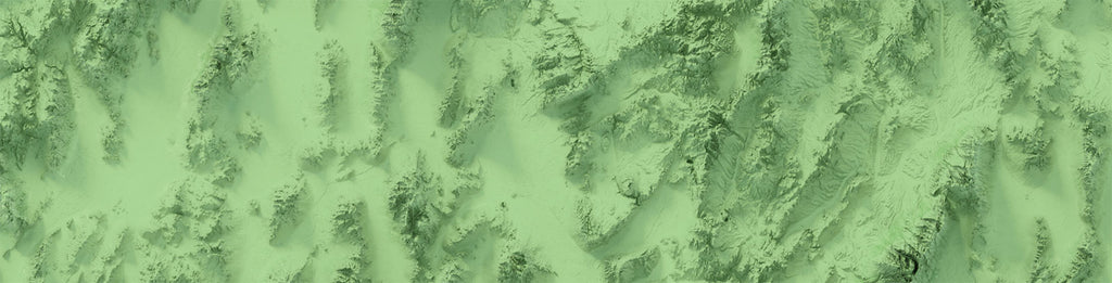
Shaded Relief
Our incredibly detailed maps are based on real earth data - the NASA ASTER digital elevation model. We project the raw remote sensing data and use it to extract surface features like coastlines in addition to the dimensions of mountains and plains. For state maps, we use the state plane projection. State maps additionally incorporate road lines from OpenStreetMap to give context to the land.
Traditional relief maps use this elevation information to apply directional light hillshading - an approximation of what land would look like if the sun did not cast shadows and mountains were made of plastic.
Shaded relief then takes it further into artistry, rendering the true details of the land that can only be revealed when depicted the way we see it in nature - with shadows, reflected light, and vivid colors.
Read more in our "The Art Behind Shaded Relief Maps" article!


